Curious Tunnel - March 2012

Derelict Places

Help Support Derelict Places:

This site may earn a commission from merchant affiliate links, including eBay, Amazon, and others.
Status
Not open for further replies.

PaulPowers

Veteran Member
Veteran Member
Joined
May 31, 2011
Messages
1,013
Reaction score
1,723
Location
High Peak, Derbyshire
Originally I was looking at a Derp above Buxton
but it was sealed on the ground floor and the flood lights shining onto it made the second floor access a bit dodgy
so I resigned myself to not getting in

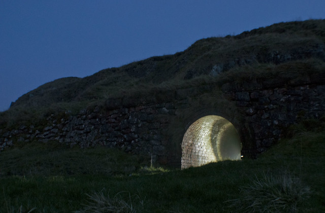
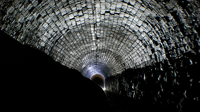
Shortly after I spotted this in the side of a hill and decided to have a look.

7012225361_66db87dd86_z.jpg


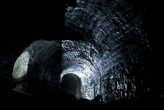
I'm not actually sure what it is, there are no buildings around and it just suddenly ends, all the walls are brick with a couple of small side arches which go back about a foot possibly for passing other people but as it's all brick I can't see how it could be a mine

7012224935_c653a37deb_z.jpg


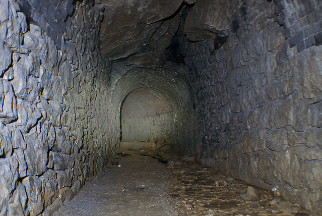
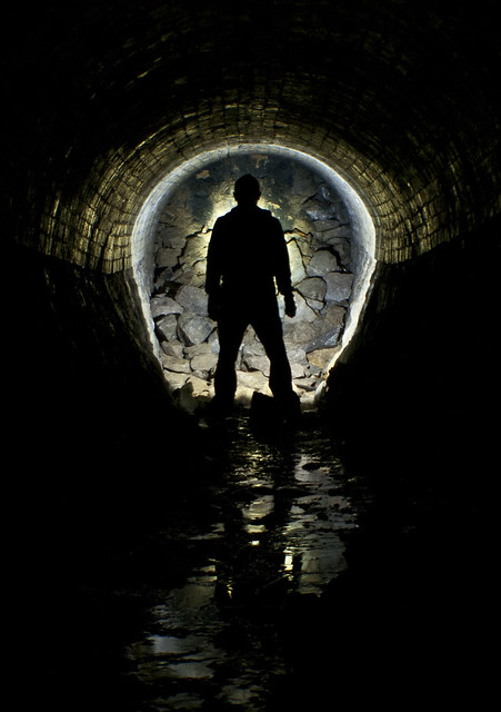
The water inside is only what is leaking from the roof and I imagine having a couple of steps inside wouldn't be practical for carts

7012227159_f5824ea472_z.jpg


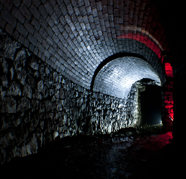
Another side arch this time taller than the first

6866115798_50048c7980_z.jpg


Close to the end is soil piled up at the side

7012228339_b4d0fb0b50_z.jpg


And then it just ends :confused:

6866114508_36d9abf077_z.jpg


Any ideas?​
 
Wow, thats strange Paul, is it not on no old maps?
 
Nope, I almost fell into a dry underground reservoir on the way back to the car as someone had nicked the manhole cover but it was quite a distance away
 
Nice that, reckon its a collapse or just the end of the tunnel?
 
Fantastic as always Mr Powers! Love the right light shot
 
Looks too narrow for standard gauge rail. Narrow gauge/light railway -maybe thats a rutway in the middle of the second pic (for horses)? How close is it to the bits that are left of the Monsal Dale/ Chee Dale railways? (Just a long shot, mind)

GDZ
 
Looks too narrow for standard gauge rail. Narrow gauge/light railway -maybe thats a rutway in the middle of the second pic (for horses)? How close is it to the bits that are left of the Monsal Dale/ Chee Dale railways? (Just a long shot, mind)

GDZ

It's next to RAF Harpur hill so it's quite a way
 
First iteration of the Cromford and High Peak Railway. Abandoned when converted to a conventional railway in around 1890 and subsequently quarried away, hence the collapse.
 
No mines in the area but it's buxton and I'm pretty sure you could dig anywhere in the area and hit a mine or cave.

I've followed the 1890 cromford line and it would have run over this :S

I think it would be too small to get a horse into it

Here is the location
http://g.co/maps/h23b8
 
No mines in the area but it's buxton and I'm pretty sure you could dig anywhere in the area and hit a mine or cave.

I've followed the 1890 cromford line and it would have run over this :S

I think it would be too small to get a horse into it

Here is the location
http://g.co/maps/h23b8

very strange! really is a mystery
 
Strange. I've seen a similar tunnel near Mitcheldean which took a tramway through a hill to a quarry. Could this be the same thing? I see there is another quarry where Grinlow Caravan Club site is. Perhaps they're connected.
 
This whole area to the south was once lime works, so maybe the intention was to mine down for new chalk instead of open-cast' extraction that we've seen evidence of down here in Kent... just a though.
 
Status
Not open for further replies.

Latest posts

Back
Top