


- Joined
- Jan 6, 2013
- Messages
- 5,575
- Reaction score
- 11,214
1. The History
The Prince of Wales slate mine at Bwlch y Ddwy Elor (meaning “The Gap of the Two Elves”) nestles in Cwm Trwsgl at the head of the Cwm Pennant valley, to the north-east of Dolbenmaen, Gwynned, It was initially worked as an open-working quarry with the slate carried north-east to Ryhd Du, under the management of William Francis, the former quarry manager at Penrhyn quarry. In the 1860s the mine was developed and started to be worked on three levels, including underground workings. Seven galleries were opened up, each connected by a single main incline, climbing up to the head of the quarry from the south. At the incline’s foot was a water-powered mill, completed in 1864 at a site known as Cwm Trwsgl, which dealt only with slab. The mill was powered by a water wheel with pillars to its left which carried the water supply from the dam up the hill to the right of the incline.
The quarry started to be worked more intensively from around 1873. This was linked to the quarry’s newly improved transportation links. The nearby Gorseddau Quarry had previously been linked to Porthmadoc by the 3ft gauge Gorseddau Tramway, which had been built earlier in 1856 as an extension of the Tremadoc tramway. The Gorseddau Quarry had been a spectacular failure and with its demise the tramway had fell into a state of disuse. However, in 1872, it was re-gauged to 2ft, renamed the Gorseddau Junction and Portmadoc Railway and extended via a new junction at Braich-y-bib for the 5 miles to take it to the foot of the incline at Prince of Wales mine.
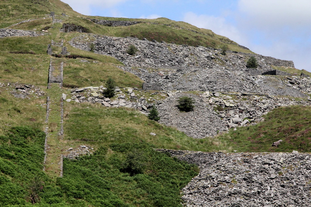
Now operating on five levels, on the top (fifth) level were a row of barracks with a row of ‘waliau’ opposite. The barracks provided accommodation for the quarrymen while the small waliau, open at one end with a sloping roof, were where one or two quarrymen would work splitting slates. The ‘worked’ areas were to the right of the spoil heaps, on the western face of Y Gyrn. The reduction of roofing slate took place on the terraces themselves, and at its brief peak, the quarry employed 200 men who produced approximately 5,000 tons of slate per annum.
Map of the quarry:
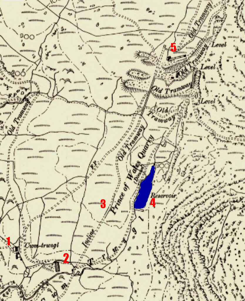 20200804_113419 by HughieDW, on Flickr
Showing:
1: The Quarry Manager’s House, 2: The Dressing Mill 3: The Drum House 4: The Reservoir and Dam 5: The Barracks and Waliau
And a Google Maps image of the main workings at the head of the quarry:
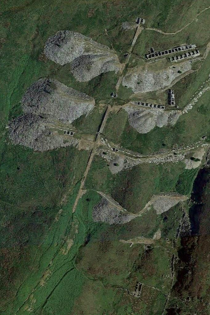 20200804_115913 by HughieDW, on Flickr
Despite being promoted by the eccentric Huddart’s of Bryncir Manor, the quarry wasn’t successful and closed prematurely in 1886, after just 13 years of operation, although some small-scale working continued until 1920. It was considered by many as a failure and described as a triumph of “geology over optimism”. Despite the infrastructure of the quarry being good and being relatively well run, the low-grade slate and relative remoteness of the quarry made it relatively uneconomic.
With the complete failure of POW, Gorseddau Quarry and nearby quarries and mines it was built to serve, by 1887 the railway had largely fallen into disused bar the occasional single wagon hand propelled to Porthmadog up until 1890. The land the railway ran on was sold in 1897 and the track and infrastructure dismantled.
2. The Explore
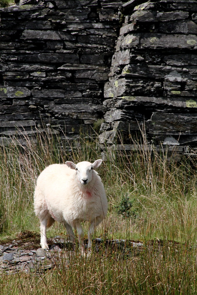
This place is a bit off the radar due to it being at the end of the road of Cwm Pennant and having parked up, a pretty steep climb up the hill to the quarry/mine. It’s open access and covered by footpaths, but despite that you are struck by the remoteness of this ill-fated venture. It’s been abandoned for well over a century so there really in a sense of nature taking back the quarry. Bar the occasional adventurous walker you’ll have the place to yourself and the many sheep.
I’d been here before to the lower levels and seen the manager’s house and the small dressing mill but hadn’t ventured up the incline to the upper levels. With the family satisfied with the views from the Lower mill level, I pushed on to the top of the quarry. I didn’t have time to fully investigate the adits and underground parts of the site so that’s one for next time.
So, nothing as spectacular in terms of the remains compared to other slate mines in North Wales but second-to-none in terms of the location and scenery that surrounds the place.
3. The Pictures
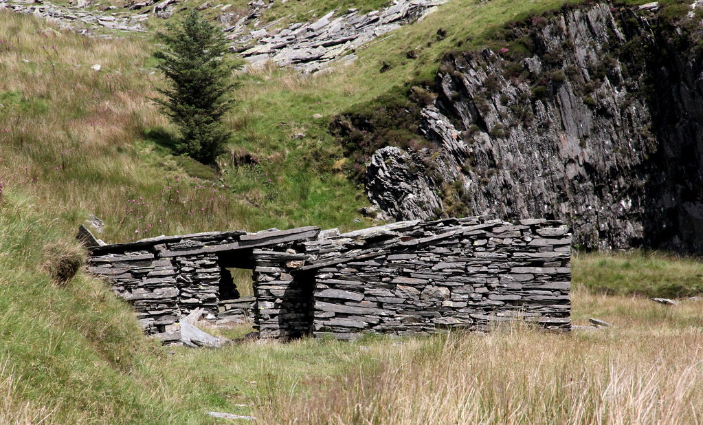
One of many ruined farmhouses in the Cwm Pennant Valley:
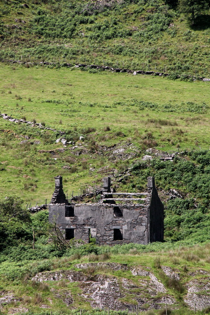 img7221 by HughieDW, on Flickr
The small Dolgarth Slate Mine slate mine on the opposite side of the valley:
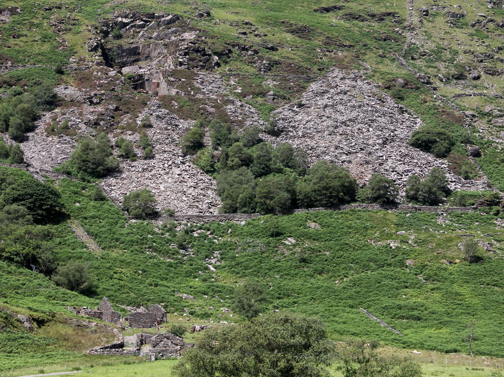 img7222 by HughieDW, on Flickr
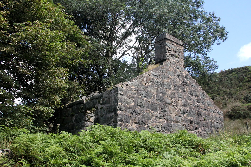
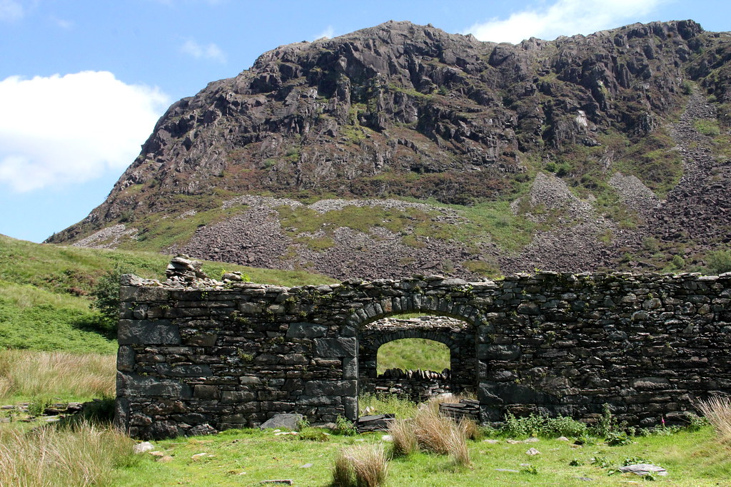
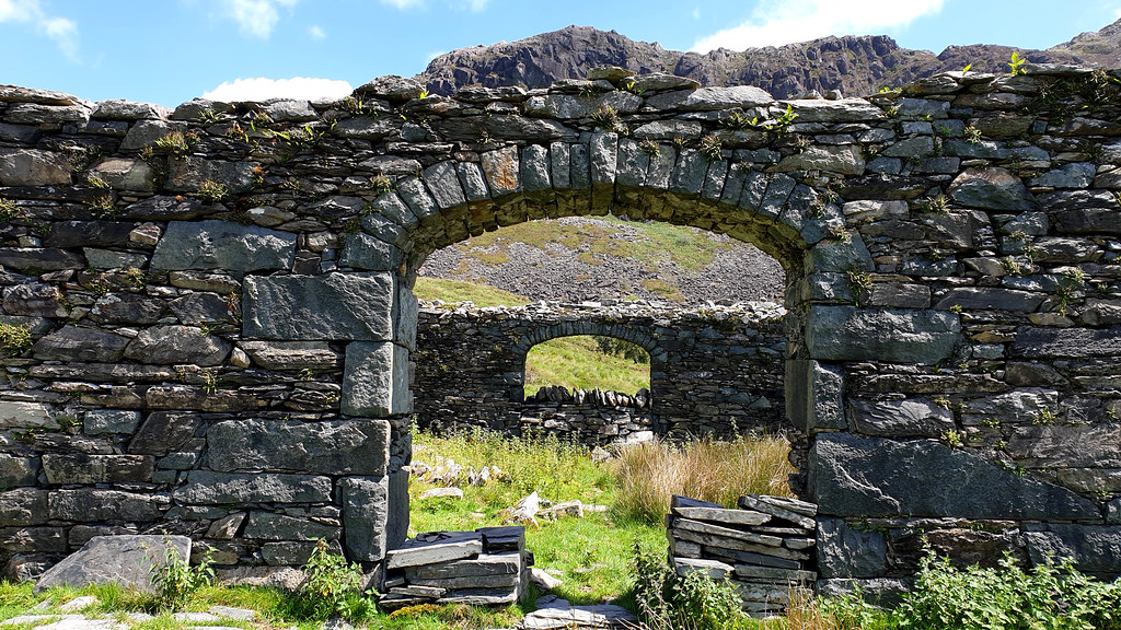
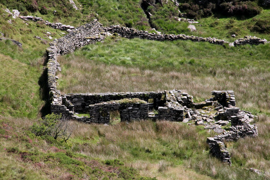
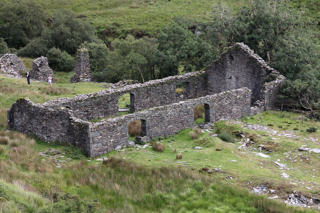
And on to the quarry manager’s house:
 img7235 by HughieDW, on Flickr
 img7229 by HughieDW, on Flickr
Main hearth:
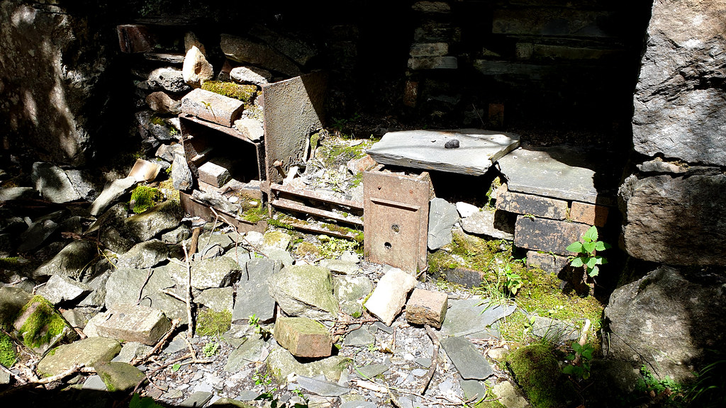 POW Slate mine 01 by HughieDW, on Flickr
Just for the record this is a similar shot taken over 20 years earlier:
 Wales 48 by HughieDW, on Flickr
And back room fireplace, made, of course, of slate!
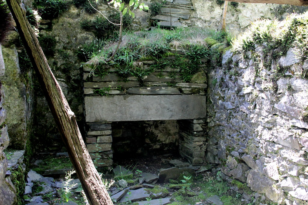 img7232 by HughieDW, on Flickr
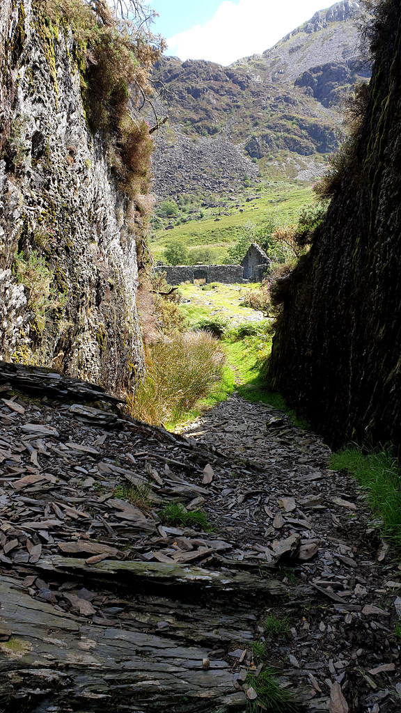
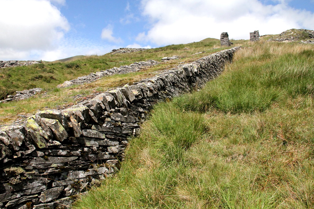
The railway cutting leading to the dressing mill:
 img7236 by HughieDW, on Flickr
 POW Slate mine 02 by HughieDW, on Flickr
And the dressing mill itself with Y Gyrn hanging above it:
 img7238 by HughieDW, on Flickr
The classic shot:
 POW Slate mine 04 by HughieDW, on Flickr
The launder pillars that supported the means that carried the water from the reservoir to the mill:
 img7240 by HughieDW, on Flickr
Mill incline drum house:
 img7243 by HughieDW, on Flickr
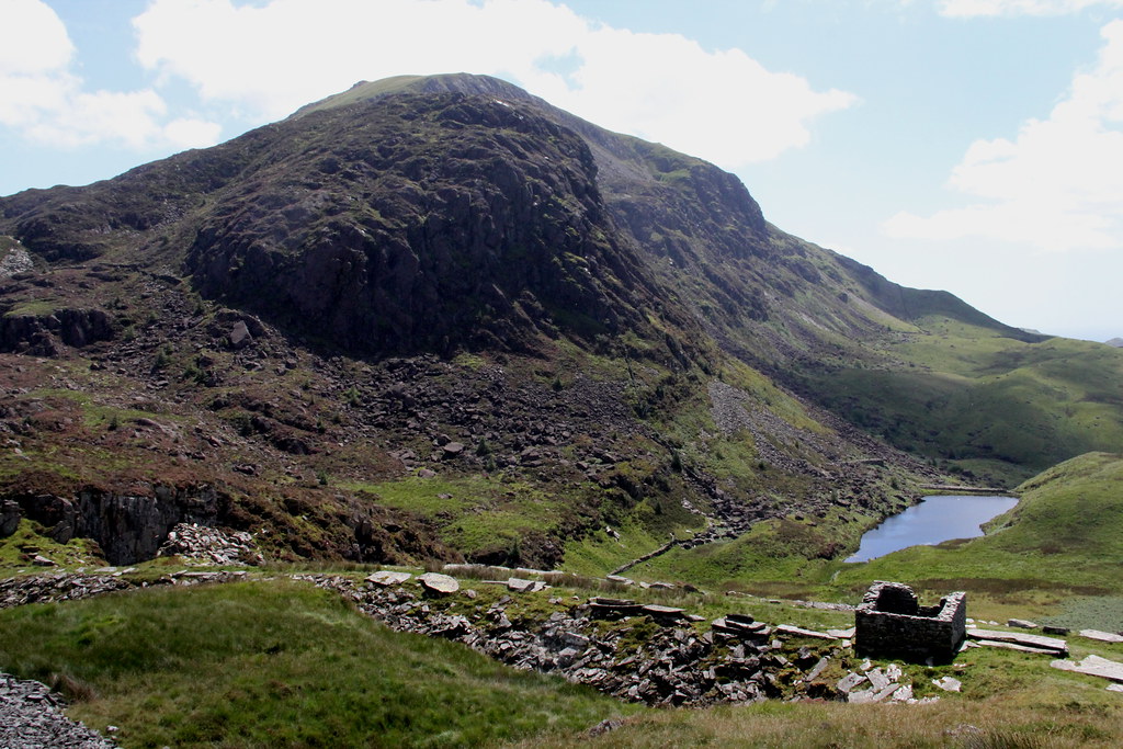
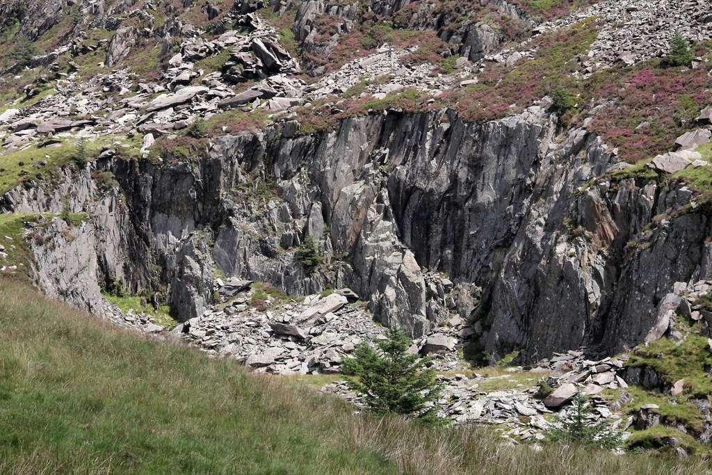
Looking up towards the head of the quarry:
 img7245 by HughieDW, on Flickr
 img7246 by HughieDW, on Flickr
Waste slabs and a weighbridge on one of the upper levels of the quarry:
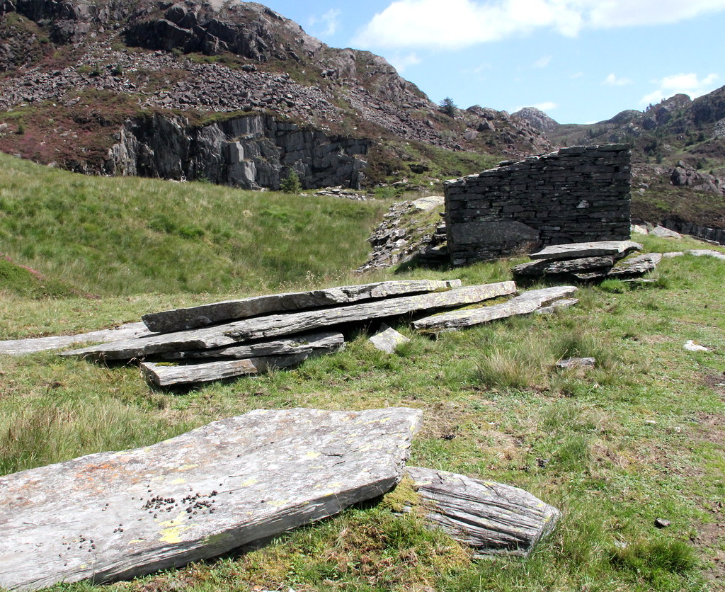 img7249 by HughieDW, on Flickr
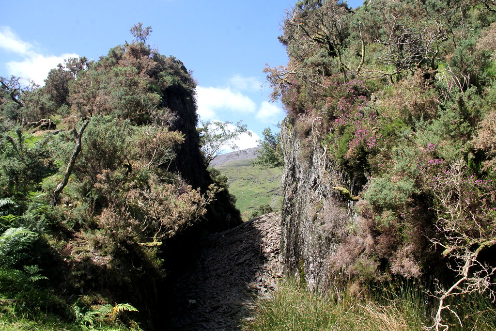
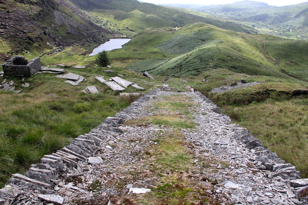
And onwards up the incline:
 img7247 by HughieDW, on Flickr
 img7250 by HughieDW, on Flickr
 img7252 by HughieDW, on Flickr
 img7251 by HughieDW, on Flickr
 img7253 by HughieDW, on Flickr
 img7259 by HughieDW, on Flickr
Right to the top:
 img7255 by HughieDW, on Flickr
Oh dear. Here’s secca:
 img7264 by HughieDW, on Flickr
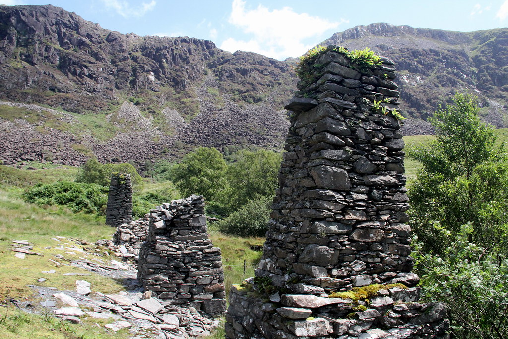
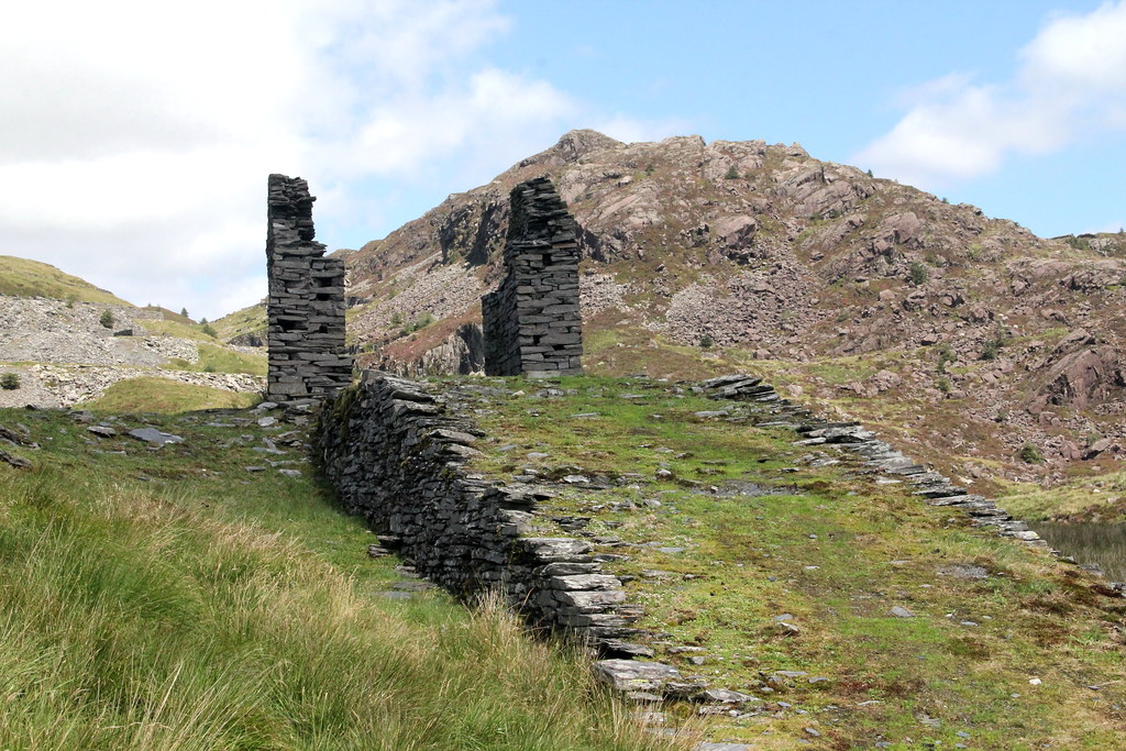
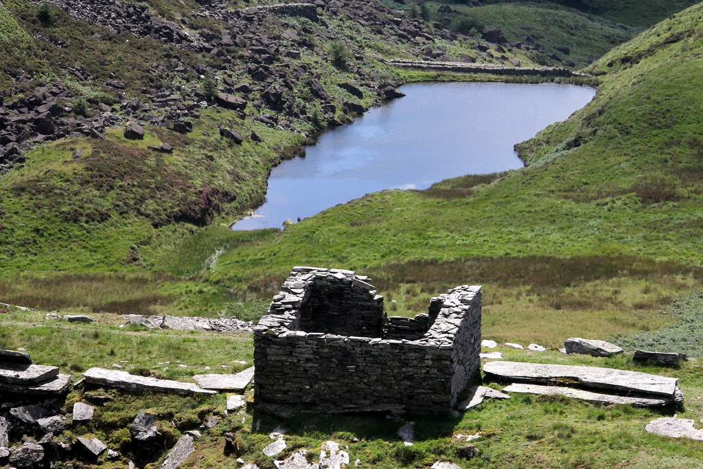
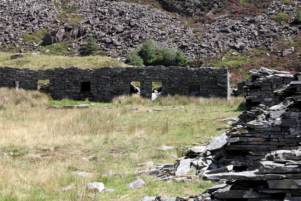
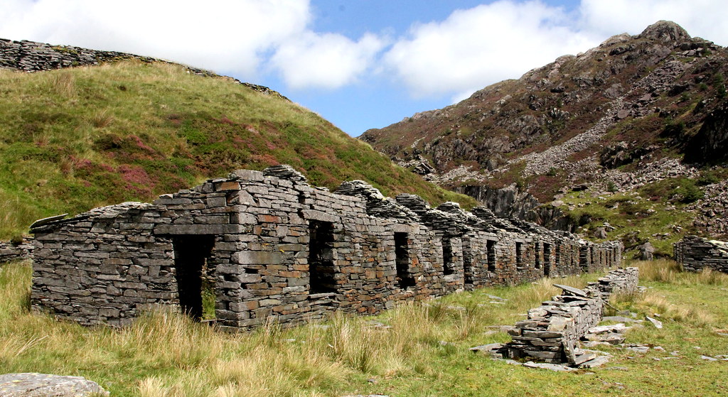
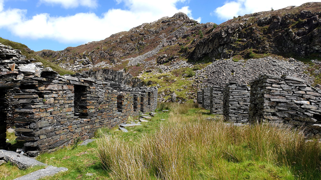
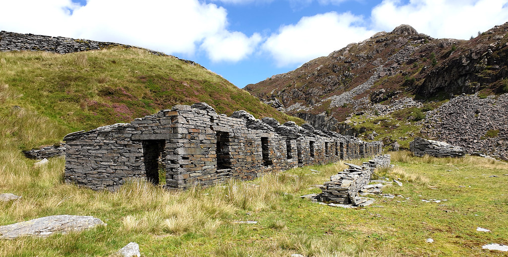
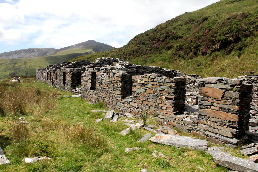
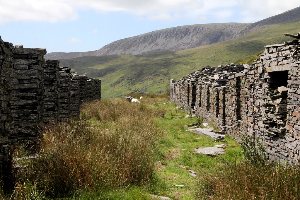
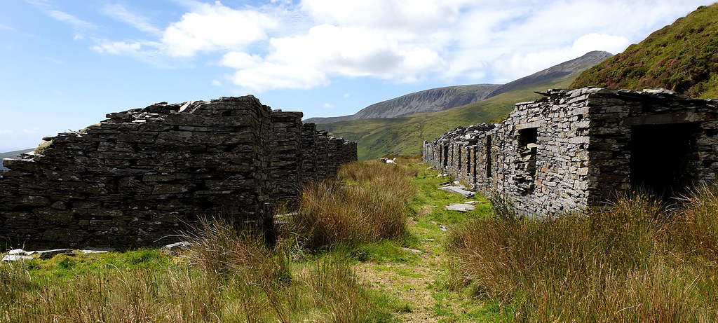
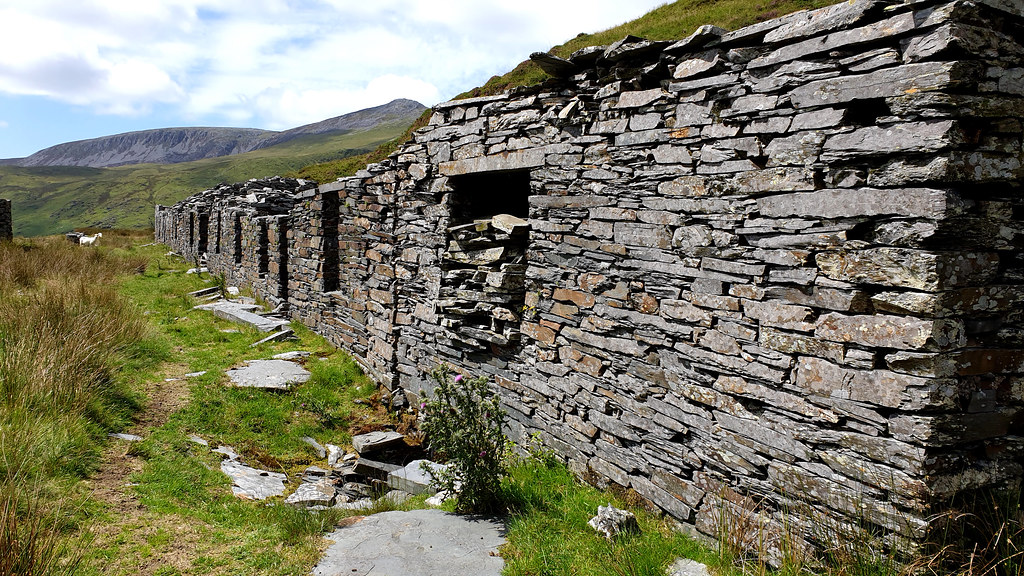
And the wonderful Quarrymen's barracks (left) and waliau (right). Waliau are open-fronted shelters where slate splitting was carried out.
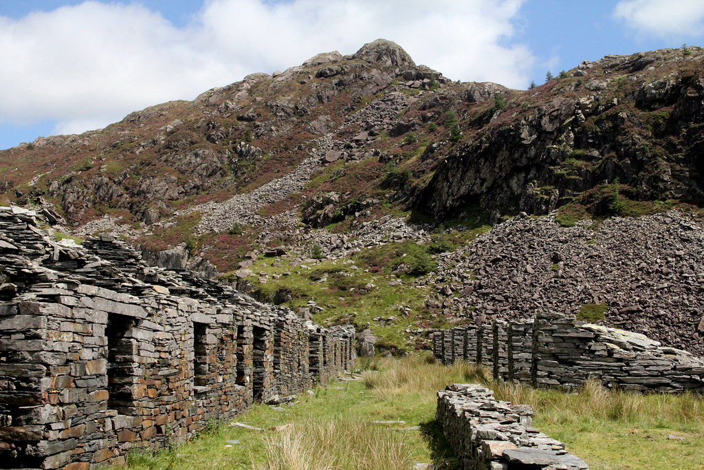 img7262 by HughieDW, on Flickr
Inside the only one of the barracks to still retain its roof:
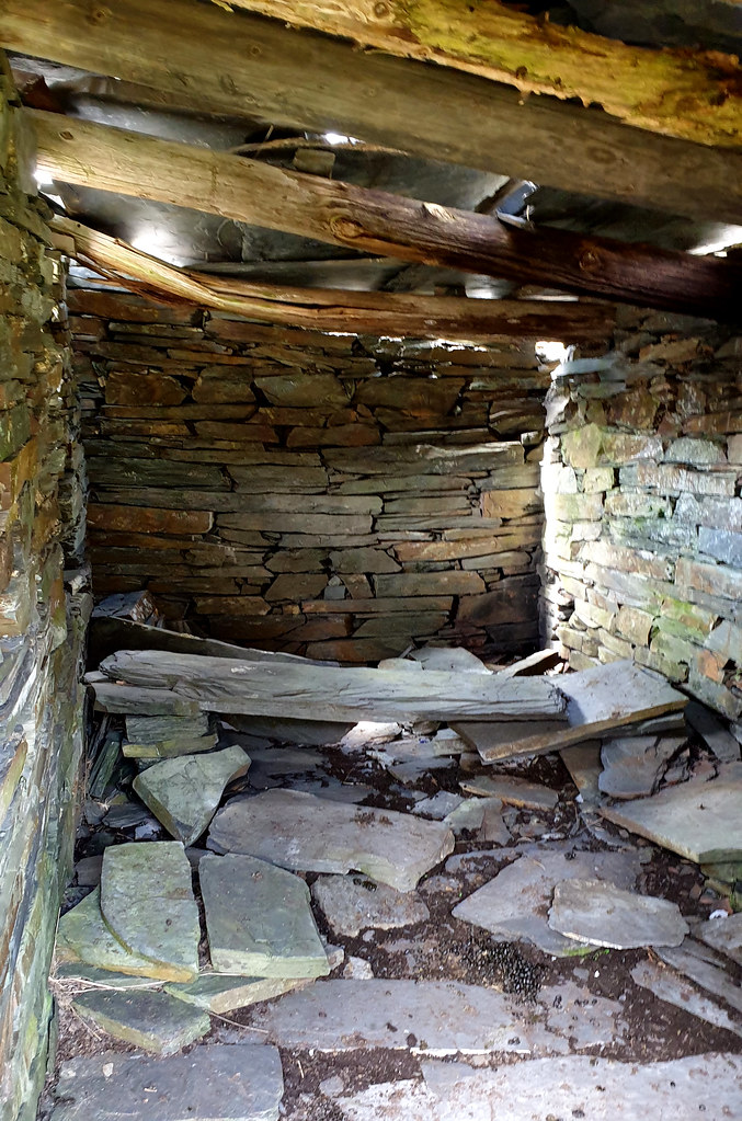 POW Slate mine 08 by HughieDW, on Flickr
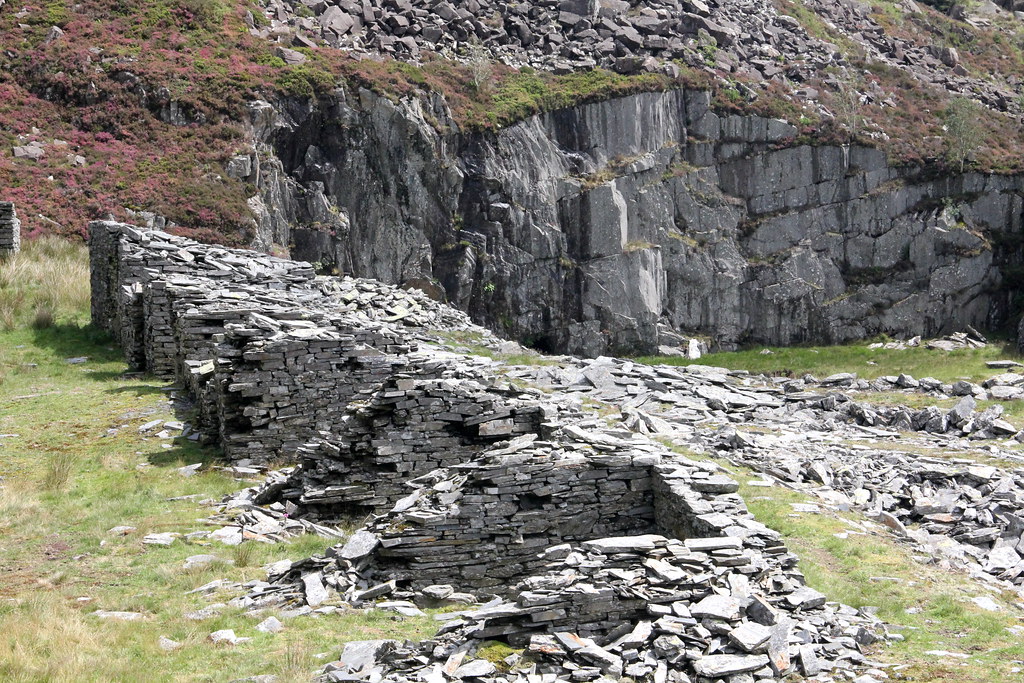
Just like a Welsh mini- Machu Picchu:
 img7265 by HughieDW, on Flickr
 POW Slate mine 09 by HughieDW, on Flickr
 POW Slate mine 09pan by HughieDW, on Flickr
 img7257 by HughieDW, on Flickr
 img7256 by HughieDW, on Flickr
 POW Slate mine 06 by HughieDW, on Flickr
 POW Slate mine 07 by HughieDW, on Flickr
And then back down again:
 img7269 by HughieDW, on Flickr
 img7270 by HughieDW, on Flickr
 img7271 by HughieDW, on Flickr
The Prince of Wales slate mine at Bwlch y Ddwy Elor (meaning “The Gap of the Two Elves”) nestles in Cwm Trwsgl at the head of the Cwm Pennant valley, to the north-east of Dolbenmaen, Gwynned, It was initially worked as an open-working quarry with the slate carried north-east to Ryhd Du, under the management of William Francis, the former quarry manager at Penrhyn quarry. In the 1860s the mine was developed and started to be worked on three levels, including underground workings. Seven galleries were opened up, each connected by a single main incline, climbing up to the head of the quarry from the south. At the incline’s foot was a water-powered mill, completed in 1864 at a site known as Cwm Trwsgl, which dealt only with slab. The mill was powered by a water wheel with pillars to its left which carried the water supply from the dam up the hill to the right of the incline.
The quarry started to be worked more intensively from around 1873. This was linked to the quarry’s newly improved transportation links. The nearby Gorseddau Quarry had previously been linked to Porthmadoc by the 3ft gauge Gorseddau Tramway, which had been built earlier in 1856 as an extension of the Tremadoc tramway. The Gorseddau Quarry had been a spectacular failure and with its demise the tramway had fell into a state of disuse. However, in 1872, it was re-gauged to 2ft, renamed the Gorseddau Junction and Portmadoc Railway and extended via a new junction at Braich-y-bib for the 5 miles to take it to the foot of the incline at Prince of Wales mine.
Now operating on five levels, on the top (fifth) level were a row of barracks with a row of ‘waliau’ opposite. The barracks provided accommodation for the quarrymen while the small waliau, open at one end with a sloping roof, were where one or two quarrymen would work splitting slates. The ‘worked’ areas were to the right of the spoil heaps, on the western face of Y Gyrn. The reduction of roofing slate took place on the terraces themselves, and at its brief peak, the quarry employed 200 men who produced approximately 5,000 tons of slate per annum.
Map of the quarry:
20200804_113419 by HughieDW, on FlickrShowing:
1: The Quarry Manager’s House, 2: The Dressing Mill 3: The Drum House 4: The Reservoir and Dam 5: The Barracks and Waliau
And a Google Maps image of the main workings at the head of the quarry:
20200804_115913 by HughieDW, on FlickrDespite being promoted by the eccentric Huddart’s of Bryncir Manor, the quarry wasn’t successful and closed prematurely in 1886, after just 13 years of operation, although some small-scale working continued until 1920. It was considered by many as a failure and described as a triumph of “geology over optimism”. Despite the infrastructure of the quarry being good and being relatively well run, the low-grade slate and relative remoteness of the quarry made it relatively uneconomic.
With the complete failure of POW, Gorseddau Quarry and nearby quarries and mines it was built to serve, by 1887 the railway had largely fallen into disused bar the occasional single wagon hand propelled to Porthmadog up until 1890. The land the railway ran on was sold in 1897 and the track and infrastructure dismantled.
2. The Explore
This place is a bit off the radar due to it being at the end of the road of Cwm Pennant and having parked up, a pretty steep climb up the hill to the quarry/mine. It’s open access and covered by footpaths, but despite that you are struck by the remoteness of this ill-fated venture. It’s been abandoned for well over a century so there really in a sense of nature taking back the quarry. Bar the occasional adventurous walker you’ll have the place to yourself and the many sheep.
I’d been here before to the lower levels and seen the manager’s house and the small dressing mill but hadn’t ventured up the incline to the upper levels. With the family satisfied with the views from the Lower mill level, I pushed on to the top of the quarry. I didn’t have time to fully investigate the adits and underground parts of the site so that’s one for next time.
So, nothing as spectacular in terms of the remains compared to other slate mines in North Wales but second-to-none in terms of the location and scenery that surrounds the place.
3. The Pictures
One of many ruined farmhouses in the Cwm Pennant Valley:
img7221 by HughieDW, on FlickrThe small Dolgarth Slate Mine slate mine on the opposite side of the valley:
img7222 by HughieDW, on FlickrAnd on to the quarry manager’s house:
img7235 by HughieDW, on Flickr
img7229 by HughieDW, on FlickrMain hearth:
POW Slate mine 01 by HughieDW, on FlickrJust for the record this is a similar shot taken over 20 years earlier:
Wales 48 by HughieDW, on FlickrAnd back room fireplace, made, of course, of slate!
img7232 by HughieDW, on FlickrThe railway cutting leading to the dressing mill:
img7236 by HughieDW, on Flickr
POW Slate mine 02 by HughieDW, on FlickrAnd the dressing mill itself with Y Gyrn hanging above it:
img7238 by HughieDW, on FlickrThe classic shot:
POW Slate mine 04 by HughieDW, on FlickrThe launder pillars that supported the means that carried the water from the reservoir to the mill:
img7240 by HughieDW, on FlickrMill incline drum house:
img7243 by HughieDW, on FlickrLooking up towards the head of the quarry:
img7245 by HughieDW, on Flickr
img7246 by HughieDW, on FlickrWaste slabs and a weighbridge on one of the upper levels of the quarry:
img7249 by HughieDW, on FlickrAnd onwards up the incline:
img7247 by HughieDW, on Flickr
img7250 by HughieDW, on Flickr
img7252 by HughieDW, on Flickr
img7251 by HughieDW, on Flickr
img7253 by HughieDW, on Flickr
img7259 by HughieDW, on FlickrRight to the top:
img7255 by HughieDW, on FlickrOh dear. Here’s secca:
img7264 by HughieDW, on FlickrAnd the wonderful Quarrymen's barracks (left) and waliau (right). Waliau are open-fronted shelters where slate splitting was carried out.
img7262 by HughieDW, on FlickrInside the only one of the barracks to still retain its roof:
POW Slate mine 08 by HughieDW, on FlickrJust like a Welsh mini- Machu Picchu:
img7265 by HughieDW, on Flickr
POW Slate mine 09 by HughieDW, on Flickr
POW Slate mine 09pan by HughieDW, on Flickr
img7257 by HughieDW, on Flickr
img7256 by HughieDW, on Flickr
POW Slate mine 06 by HughieDW, on Flickr
POW Slate mine 07 by HughieDW, on FlickrAnd then back down again:
img7269 by HughieDW, on Flickr
img7270 by HughieDW, on Flickr
img7271 by HughieDW, on Flickr