


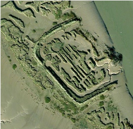
Between Canvey Island and Coryton lies the very small island of 'Upper Horse' (lower horse is below and slightly larger, yet insignificant) which can be seen clearly, via satellite imagery, like Google Maps, to show an orderly and man-made 'enclosure' built into the earthworks of it. Speculation and experts say it is probably the remains of a roman fort, although from old maps it depicts proper walkways around the edge in the Victorian era, and one or two tiny 'pens' on it. It apears that this island was used as a roman fort, with the edges of it built upon in the Victorian era as a seawall. All that remains now is the unatural shape, and the clearly raised 'wall' which is built up hence having inland long grass on it unlike the rest of the island, being simply marsh.
Below is an aerial pic, and a pic from the Canvey side, faintly showing the grassy mounds. For exclusive pictures of plenty of old maps, and a detailed investigtion, visit my site here: http://beyondthepoint.co.uk/2011/11/12/old-maps-of-upper-horse-island/

Below is an aerial pic, and a pic from the Canvey side, faintly showing the grassy mounds. For exclusive pictures of plenty of old maps, and a detailed investigtion, visit my site here: http://beyondthepoint.co.uk/2011/11/12/old-maps-of-upper-horse-island/
Last edited: