


- Joined
- Jun 7, 2014
- Messages
- 2,910
- Reaction score
- 4,746
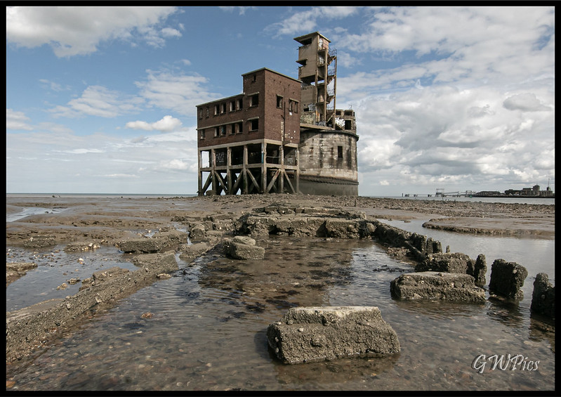
Grain Tower Fort
You may already know this but...
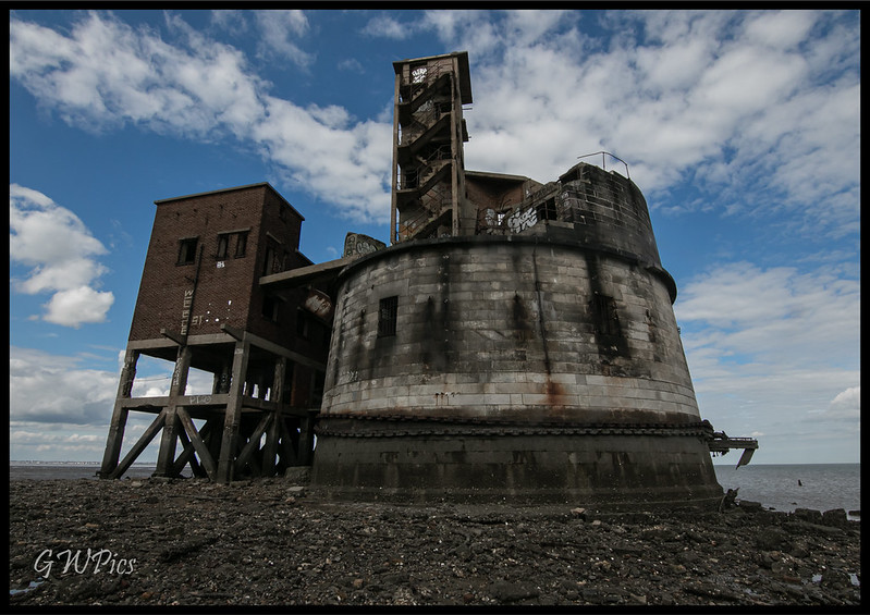
Grain Tower is a mid-19th-century gun tower situated offshore just east of Grain, Kent, standing in the mouth of the River Medway. It was built along the same lines as the Martello towers that were constructed along the British and Irish coastlines in the early 19th century and is the last-built example of a gun tower of this type. It owed its existence to the need to protect the important dockyards at Sheerness and Chatham from a perceived French naval threat during a period of tension in the 1850s
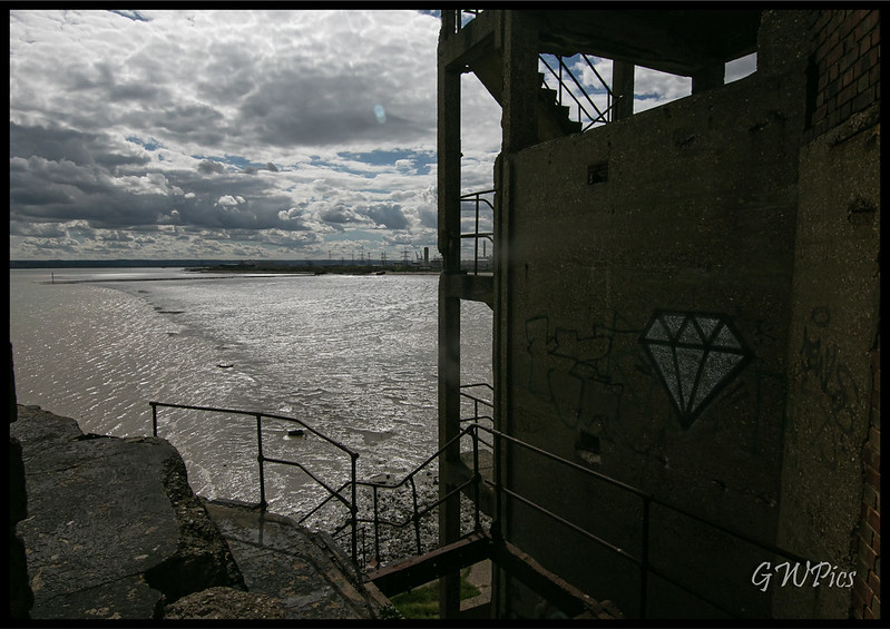
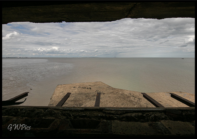
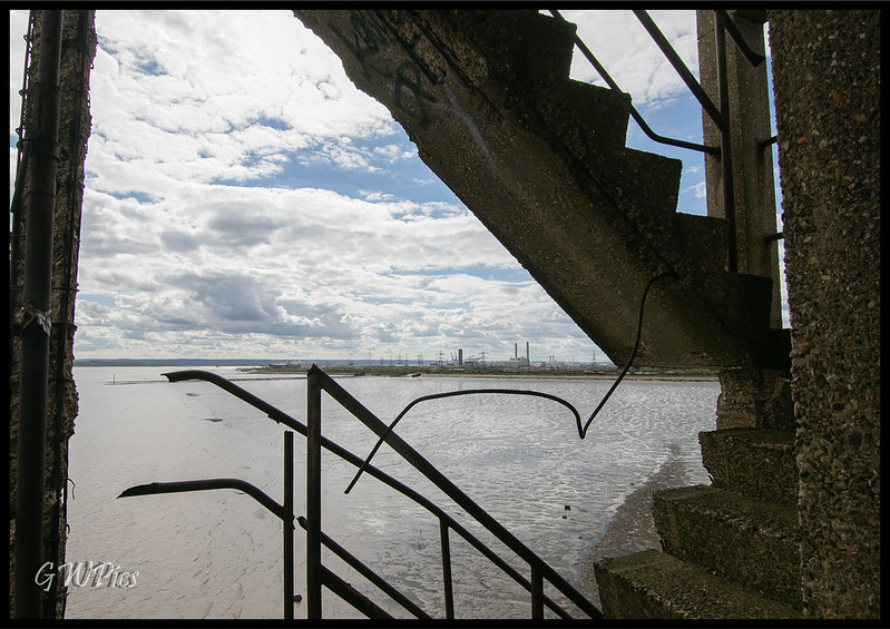
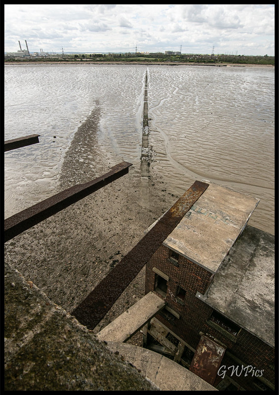
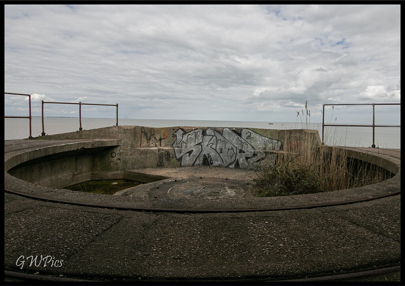
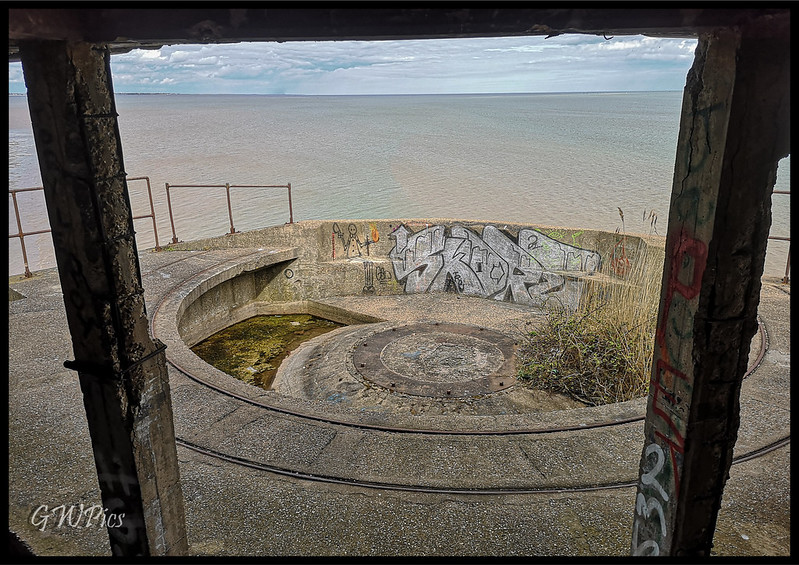
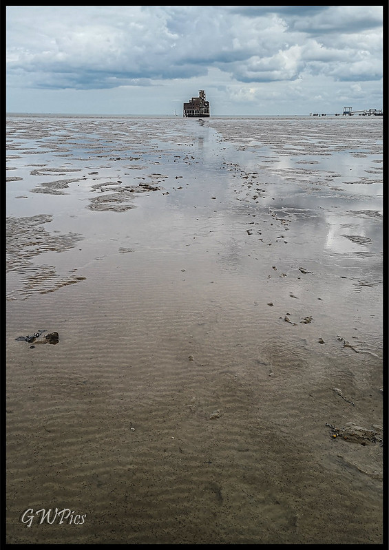
Grain Tower stands about 500 metres (1,600 ft) offshore at the eastern tip of the Isle of Grain, where the mouth of the Medway meets the Thames. It was constructed on the tidal sandbank of Grain Spit and is reached by a causeway running in an east–west direction from the shoreline. Its location enabled the tower's arc of fire to overlap with that of the guns at Garrison Point on the Isle of Sheppey, on the other side of the Medway
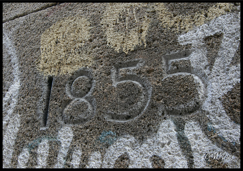
Construction began in 1848 but difficulties were soon encountered in laying the foundations and construction paused until 1853. It took nearly two years for the Lincolnshire builders Kirk and Parry to construct the rest of the tower; as the York Herald newspaper noted, "from the exposed situation of the tower, which is subject to the sea and weather, very great difficulties were experienced during the winter months in proceeding with the work." It was completed in late 1855 and was handed over to the Ordnance authorities on 17 November that year. By this point it had gone more than 50 percent over budget, costing £16,798 (equivalent to £1,704,850 today)
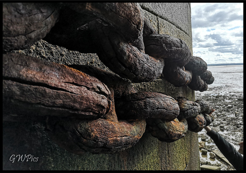
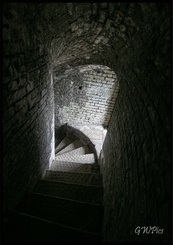
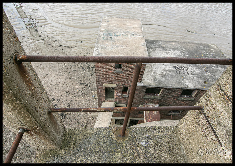
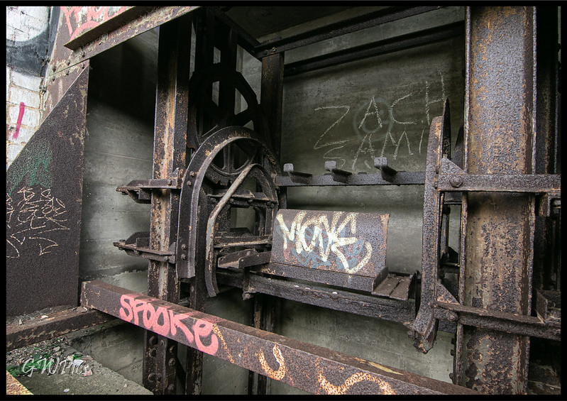
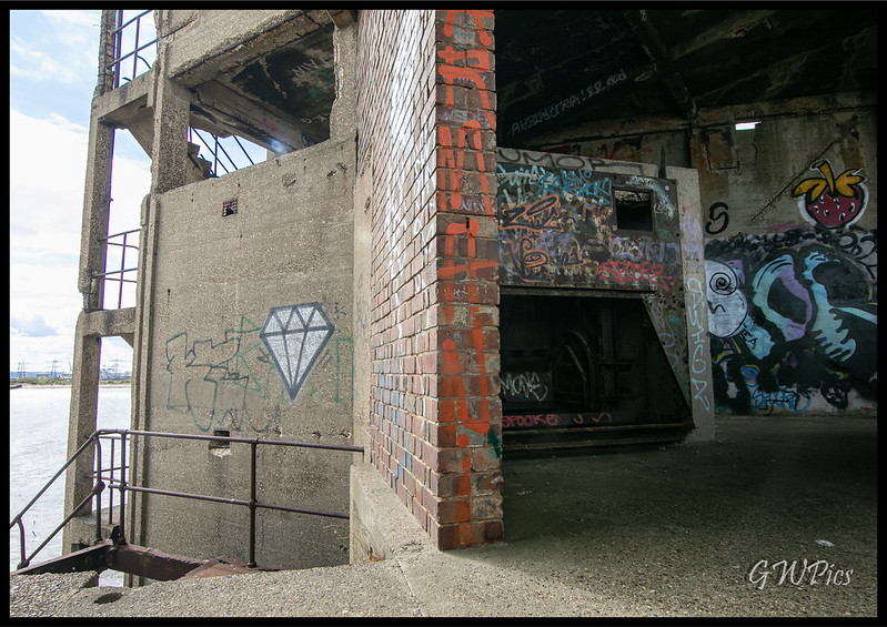
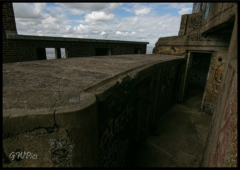
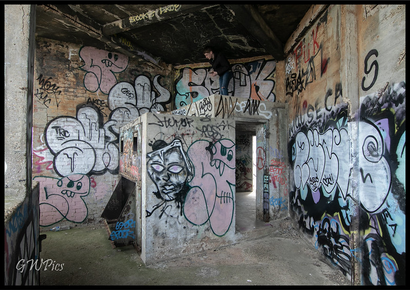
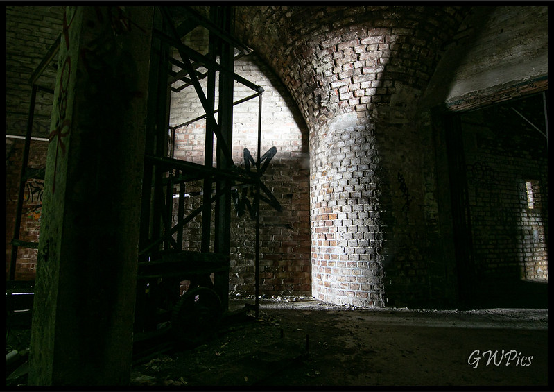
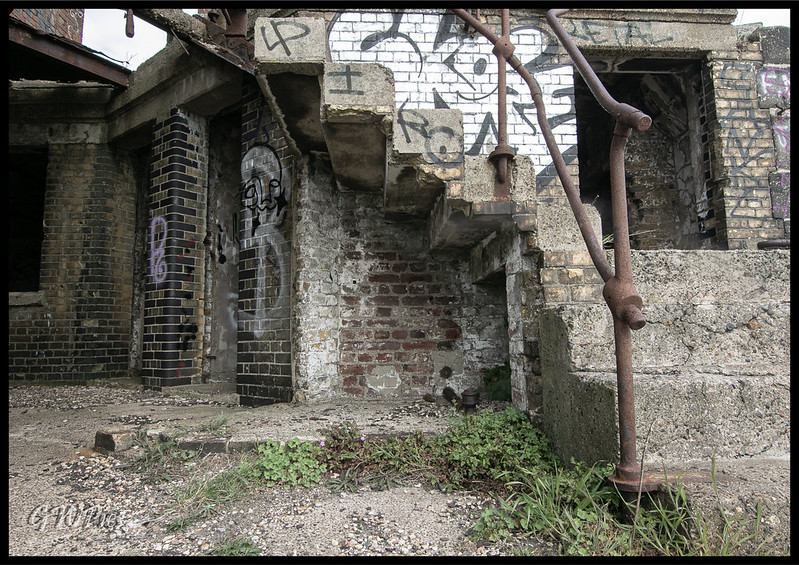
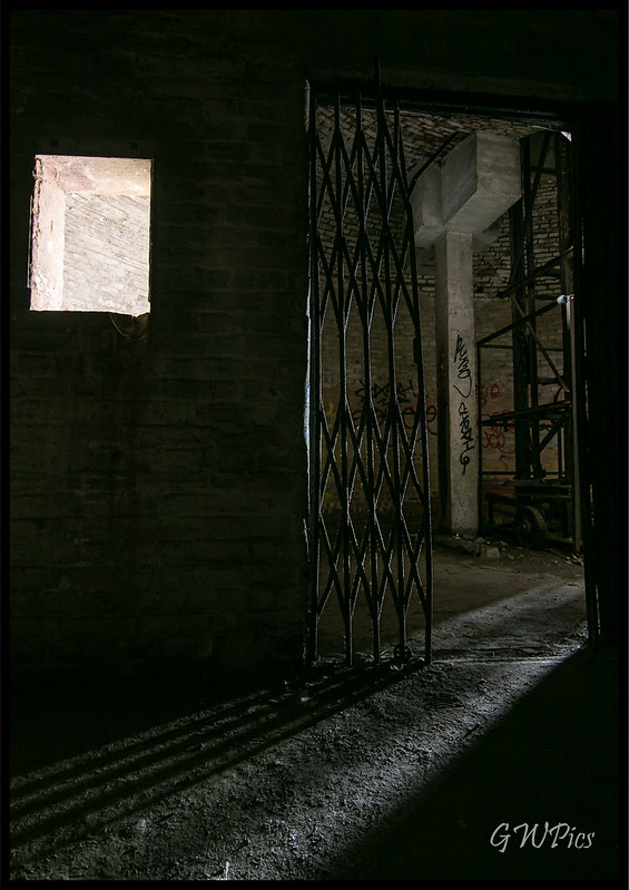
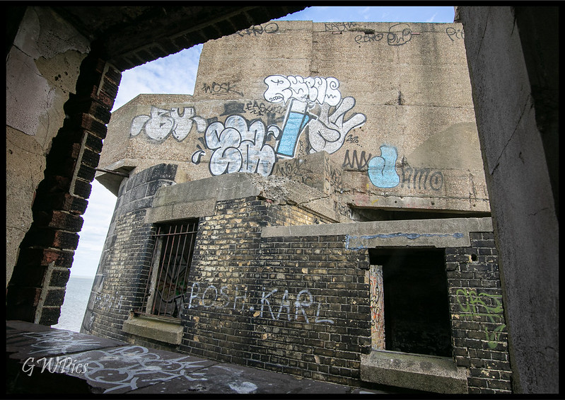
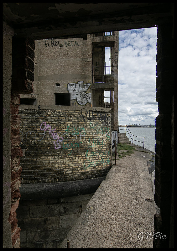
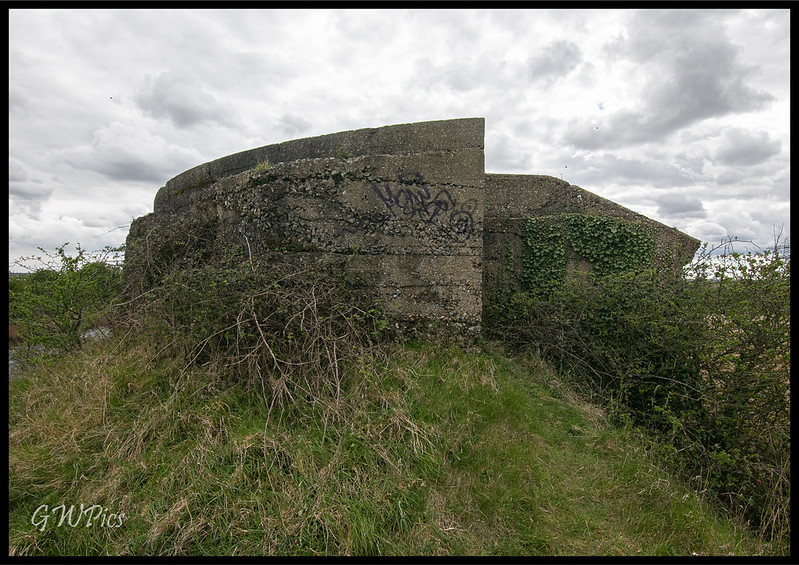
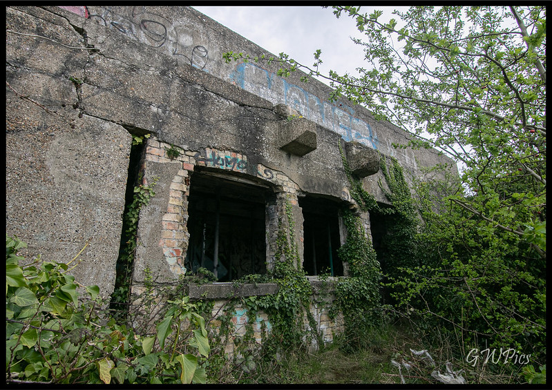
The tower stands three storeys high, faced in granite ashlar, and is roughly oval in shape. Its base is 21.8 by 19.3 metres (72 by 63 ft), its original height was 12.9 metres (42 ft), and it has walls 3.6 metres (12 ft) thick. The gun crews lived in barrack accommodation within the tower, which also housed stores and ammunition. Its overall design is similar to that of a Martello tower, dozens of which were built around the coasts of Britain and Ireland during the Napoleonic Wars at the start of the 19th century; it can be considered the last Martello tower to be built in Britain although the similar Bréhon Tower off the coast of Guernsey was finished in 1857
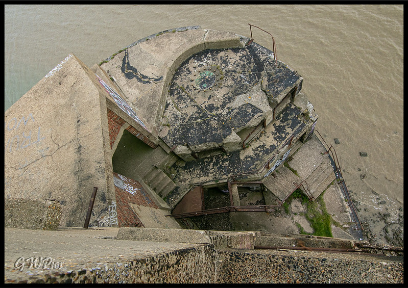
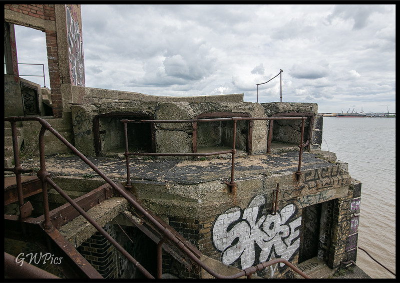
Rapid improvements to artillery technology in the mid-19th century meant that the tower was effectively obsolete as soon as it had been completed. A proposal to turn it into a casemated fort was dropped for being too expensive. By the end of the 19th century the tower had gained a new significance as a defence against raids by fast torpedo boats.
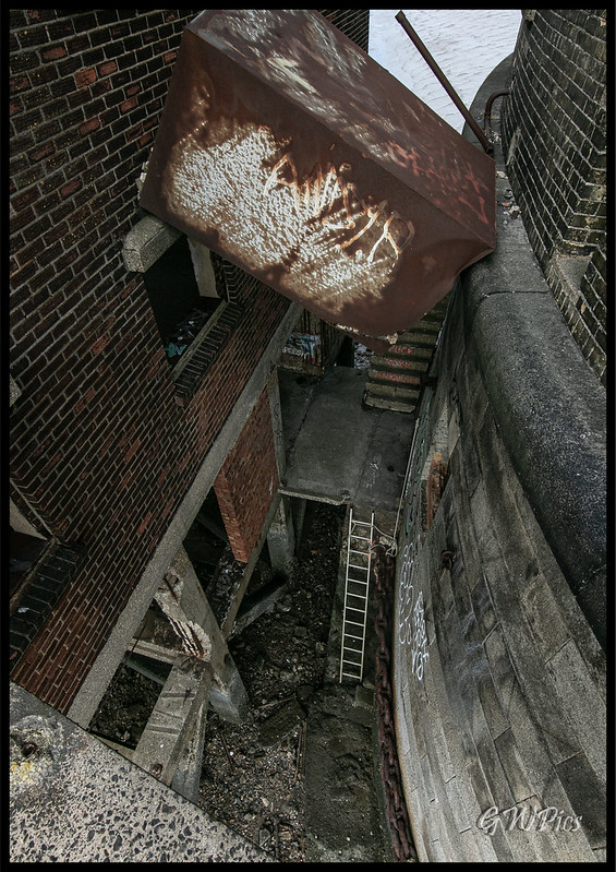
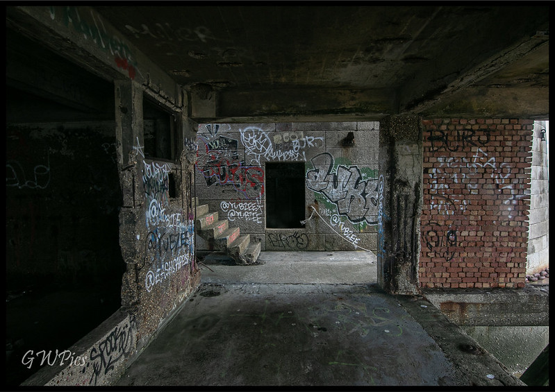
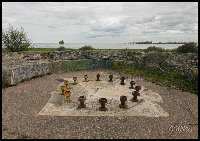
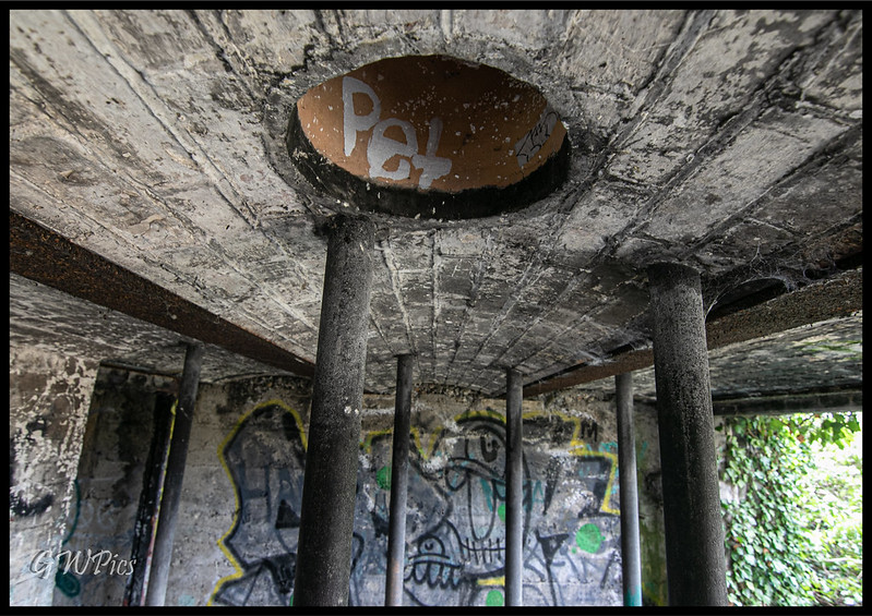
It was used in both the First and Second World Wars, when its fabric was substantially altered to support new quick-firing guns. It was decommissioned in 1956 and remains derelict today. The tower has been privately owned since 2005 and was reportedly sold to a new owner in 2014 for £400,000.
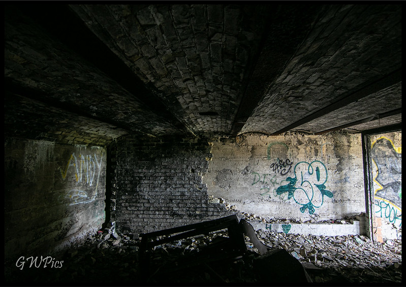
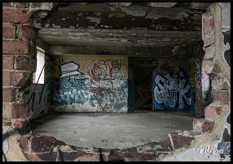
Visited here while on holiday with my lad & it was reet good fun. We got bored waiting so waded through the last few inches as the tide receded which gave us half hour alone on the fort before the inevitable goon waving a go pro about arrived.
To be honest though there was only a few people turned up within our hour or so we spent here so it was rather peaceful, we went straight to the top & worked our way back down.
Back on dry land
Thanks For Looking
You may already know this but...
Grain Tower is a mid-19th-century gun tower situated offshore just east of Grain, Kent, standing in the mouth of the River Medway. It was built along the same lines as the Martello towers that were constructed along the British and Irish coastlines in the early 19th century and is the last-built example of a gun tower of this type. It owed its existence to the need to protect the important dockyards at Sheerness and Chatham from a perceived French naval threat during a period of tension in the 1850s
Grain Tower stands about 500 metres (1,600 ft) offshore at the eastern tip of the Isle of Grain, where the mouth of the Medway meets the Thames. It was constructed on the tidal sandbank of Grain Spit and is reached by a causeway running in an east–west direction from the shoreline. Its location enabled the tower's arc of fire to overlap with that of the guns at Garrison Point on the Isle of Sheppey, on the other side of the Medway
Construction began in 1848 but difficulties were soon encountered in laying the foundations and construction paused until 1853. It took nearly two years for the Lincolnshire builders Kirk and Parry to construct the rest of the tower; as the York Herald newspaper noted, "from the exposed situation of the tower, which is subject to the sea and weather, very great difficulties were experienced during the winter months in proceeding with the work." It was completed in late 1855 and was handed over to the Ordnance authorities on 17 November that year. By this point it had gone more than 50 percent over budget, costing £16,798 (equivalent to £1,704,850 today)
The tower stands three storeys high, faced in granite ashlar, and is roughly oval in shape. Its base is 21.8 by 19.3 metres (72 by 63 ft), its original height was 12.9 metres (42 ft), and it has walls 3.6 metres (12 ft) thick. The gun crews lived in barrack accommodation within the tower, which also housed stores and ammunition. Its overall design is similar to that of a Martello tower, dozens of which were built around the coasts of Britain and Ireland during the Napoleonic Wars at the start of the 19th century; it can be considered the last Martello tower to be built in Britain although the similar Bréhon Tower off the coast of Guernsey was finished in 1857
Rapid improvements to artillery technology in the mid-19th century meant that the tower was effectively obsolete as soon as it had been completed. A proposal to turn it into a casemated fort was dropped for being too expensive. By the end of the 19th century the tower had gained a new significance as a defence against raids by fast torpedo boats.
It was used in both the First and Second World Wars, when its fabric was substantially altered to support new quick-firing guns. It was decommissioned in 1956 and remains derelict today. The tower has been privately owned since 2005 and was reportedly sold to a new owner in 2014 for £400,000.
Visited here while on holiday with my lad & it was reet good fun. We got bored waiting so waded through the last few inches as the tide receded which gave us half hour alone on the fort before the inevitable goon waving a go pro about arrived.
To be honest though there was only a few people turned up within our hour or so we spent here so it was rather peaceful, we went straight to the top & worked our way back down.
Back on dry land
Thanks For Looking

