


- Joined
- Jan 6, 2013
- Messages
- 5,574
- Reaction score
- 11,213
After a failed explore somewhere else, this was the morning’s fall back and Plan B. Nothing spectacular or mega. And not enough for a report individually, but together these three curios of a time gone by make a nice trio.
Map:
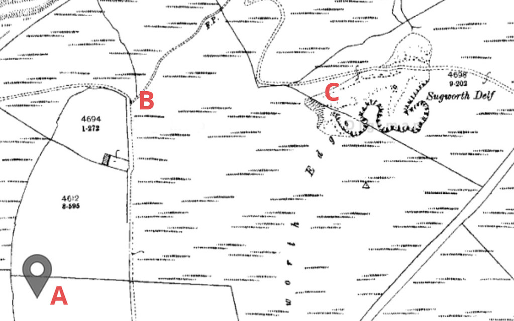
A: Boot’s Folly
B: Doric Columns
C: Sugworth Delph Quarry
1. Boot’s Folly:
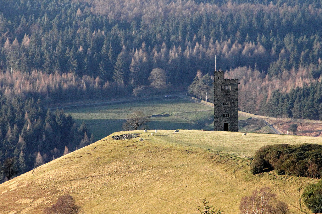
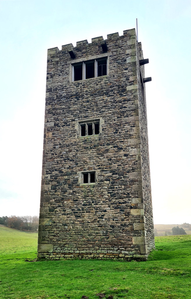
High on the south bank of the Strines reservoir, at a height of 315 metres, stands Boot's Folly. Also known as Strines Tower or Sugworth Tower, the folly’s official name came from its constructer, Charles Boot, who built the folly in 1927, who resided in the nearby Sugworth Hall. His father was the founder of the local construction company, Henry Boot plc. The 45-foot-high square tower with castellated top and flagpole was built from leftover stone from nearby Bent’s House. In turn the stone for Bents House had come from the disused Bents Farm, Pears House Farm and Nether Holes Farm which had been demolished because they were suspected of polluting the waters in the dale. Boot's Folly was most likely constructed to provide work for Sugworth Hall’s workmen during The Depression. There is also a theory that Charles Boot built the tower so he could see High Bradfield churchyard where his wife who had died the year before in 1926, aged 56, was buried.
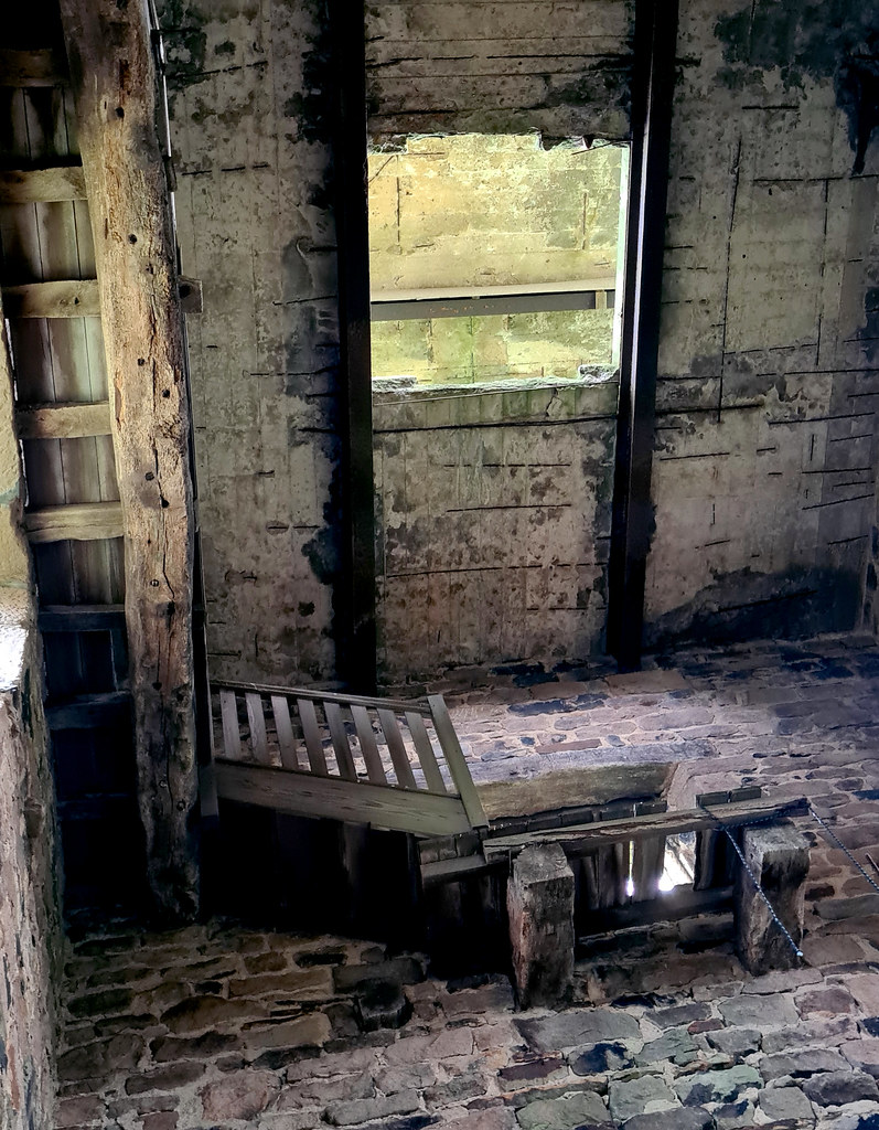
The interior is now bare. It originally had wood panelling and a large furnished room at the top where the Boot family could enjoy panoramic views across the moors. There was a spiral staircase to the top. This was removed, however, some years ago after a cow climbed the stairs and became stuck. The Folly gives fine views of the reservoir and Bradfield Dale.
The folly can be seen from miles around:
The folly is pretty sturdy:
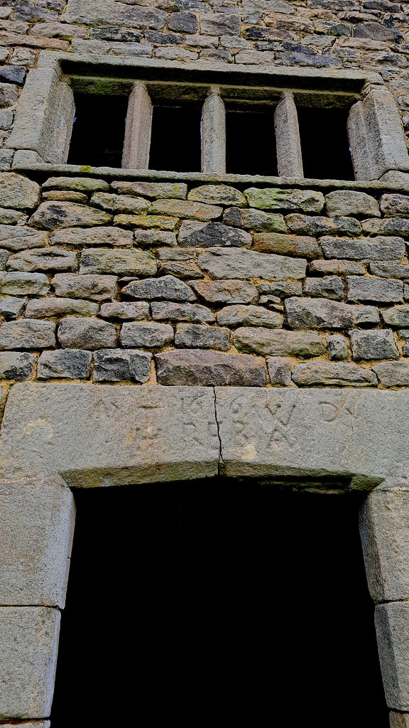
Can’t make out what the door lintel stone says on it:
Inside, sadly, no way up:
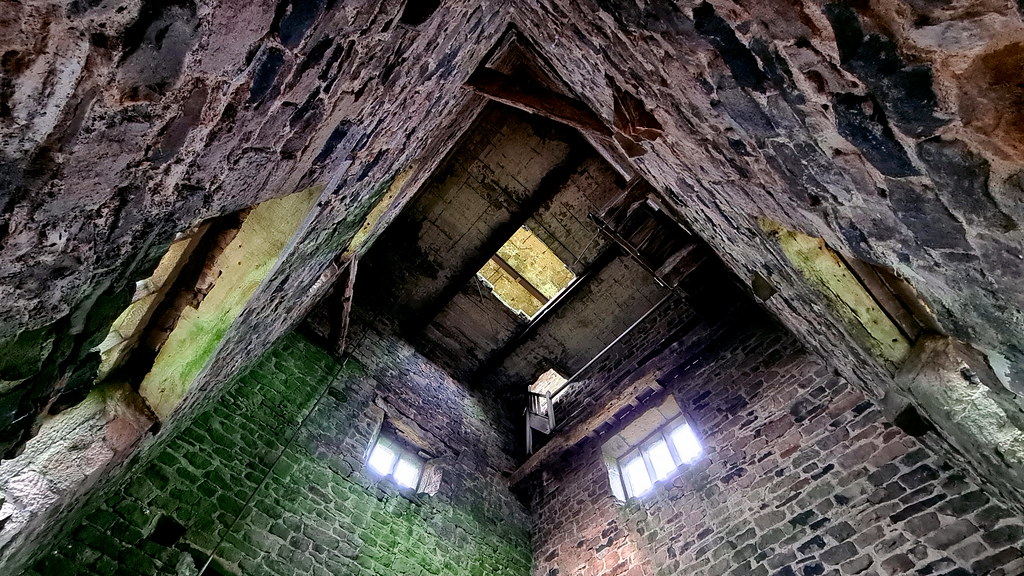
The remnants of the former staircase:
2. Doric columns
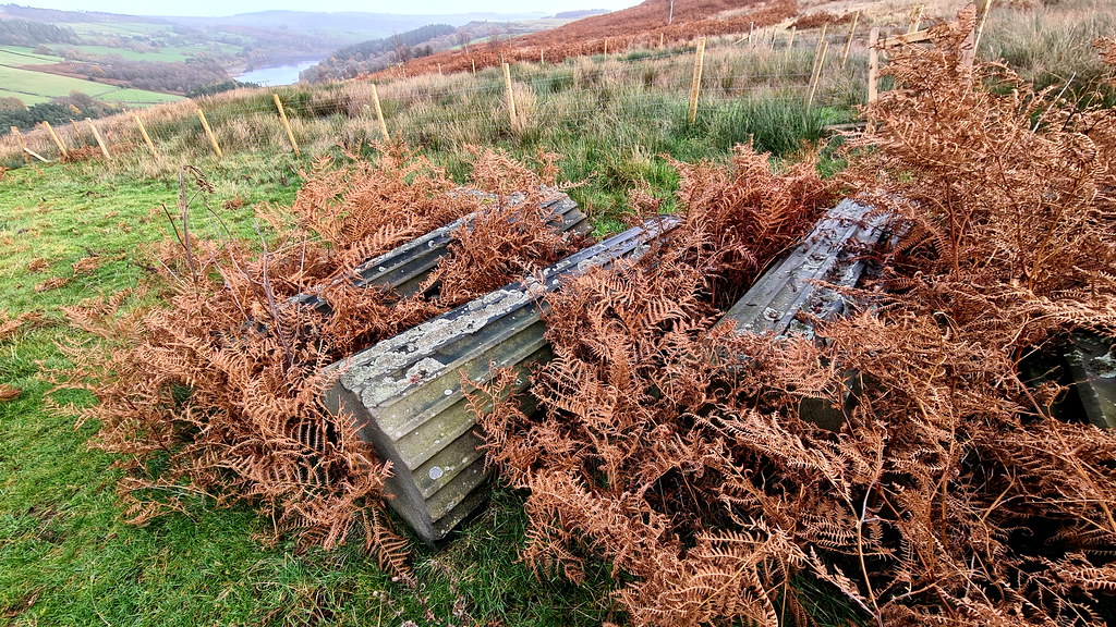
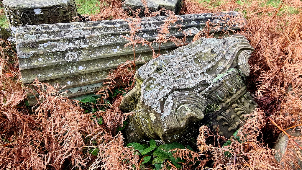
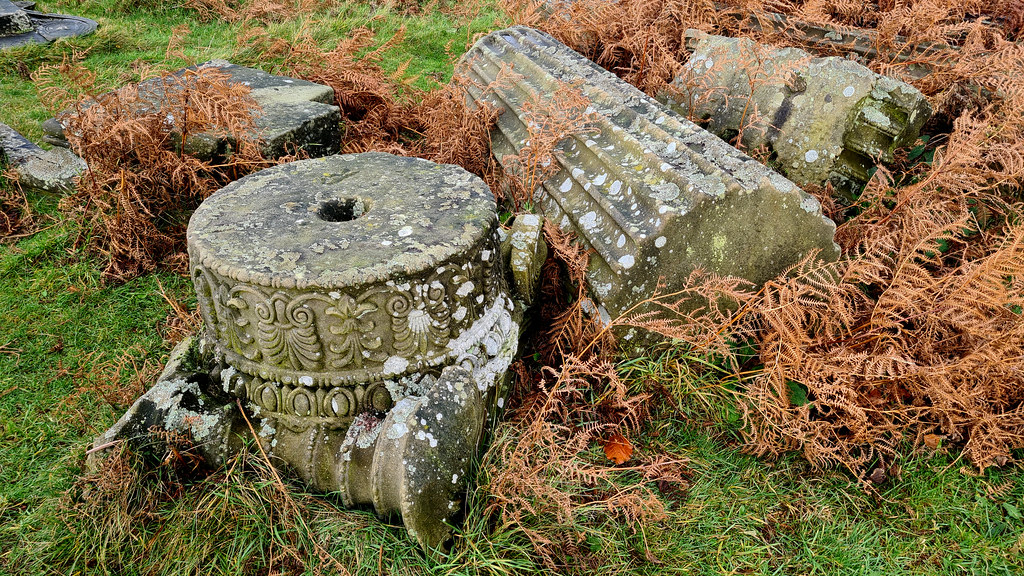
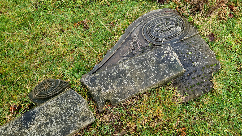
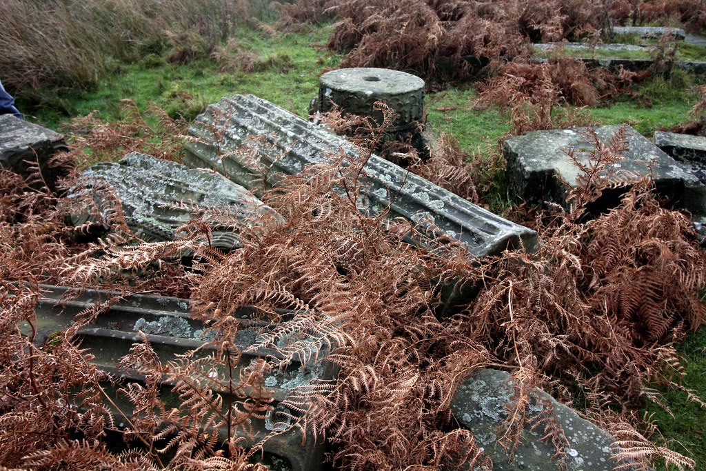
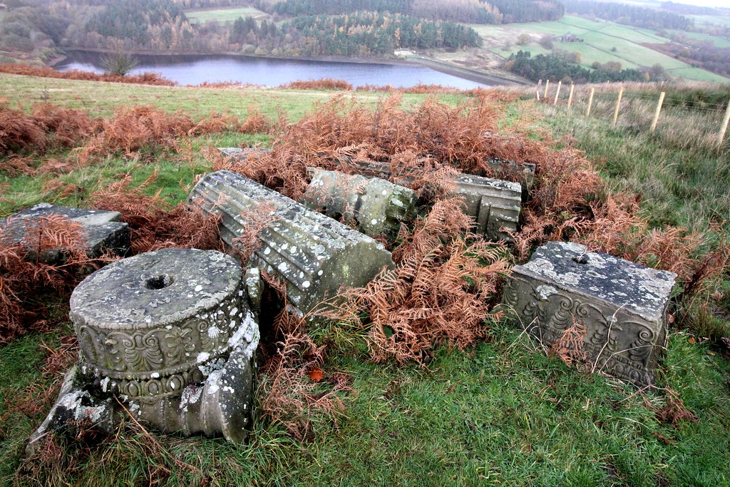
Nearby, laid out on the grass, are as set of beautifully carved columns and capitals. The stones were originally part of Brunswick Chapel which was at the bottom of Sheffield Moor and designed by architect John Grey Weightman. Constructed in 1833, the chapel was bombed during the Second World War. After the war, Mr Boot was charged with demolishing the chapel safe, so too the opportunity to salvage the masonry, bringing it up to his house on the moors for safe keeping. He may have even planned to build a smaller folly using the stones.
The columns with the folly in the background:
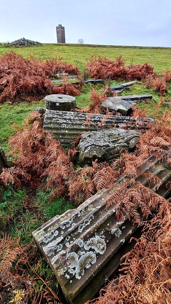
Some cracking Corinthian capitals:
Just sat there, doing nothing:
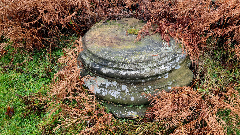
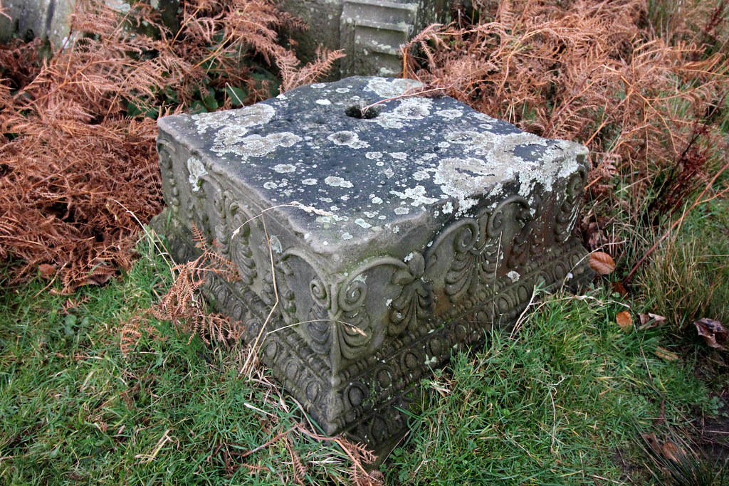
A square base here:
Strines reservoir in the background:
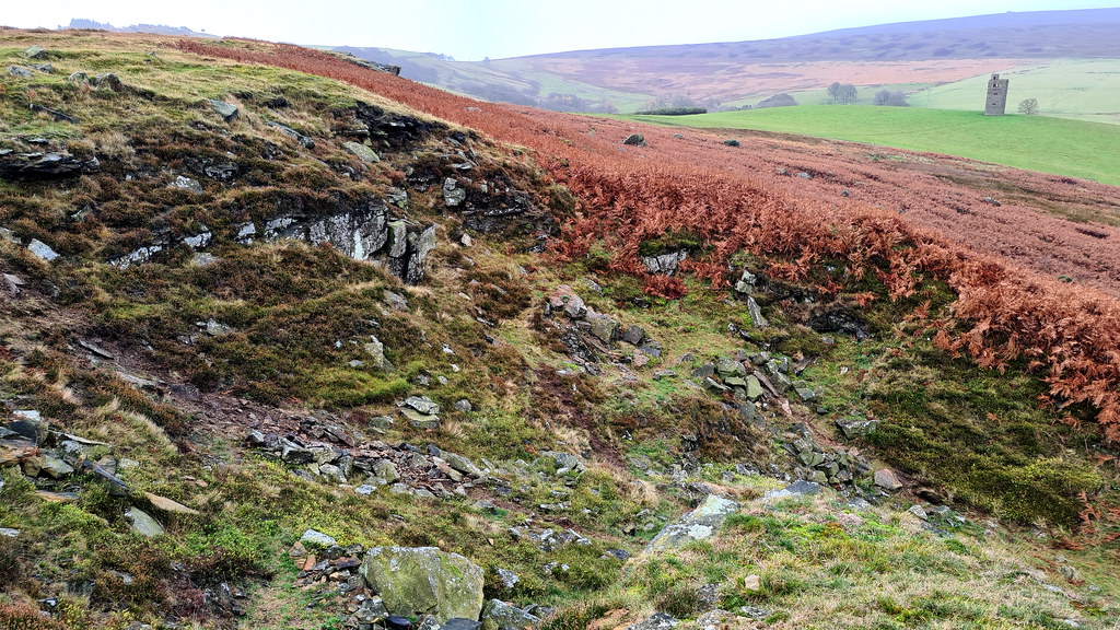
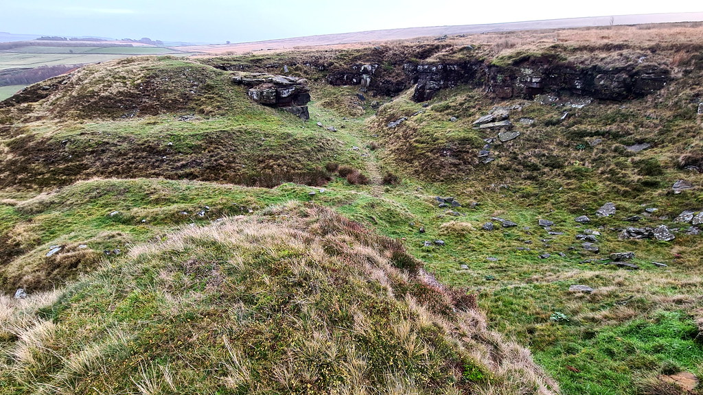
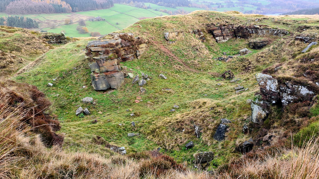
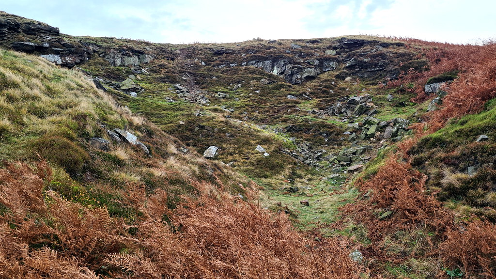
3. Sugworth Delph Quarry
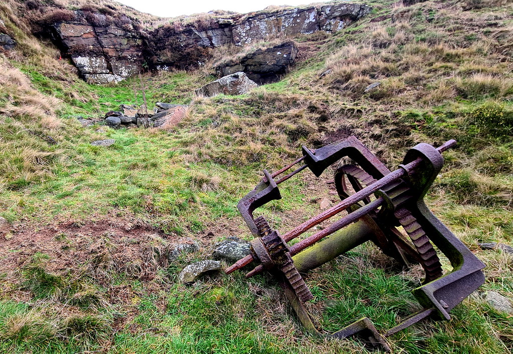
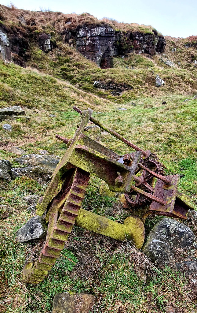
A small stone quarry, due east of the stones. No information on this place whatsoever, so hard to cast any light on what was quarried and when the quarry was active. Interesting to see some on the machinery used in the quarry still in situ.
The quarry is small but quite photogenic:
Tower of stone:
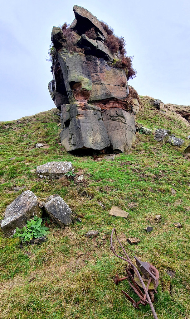
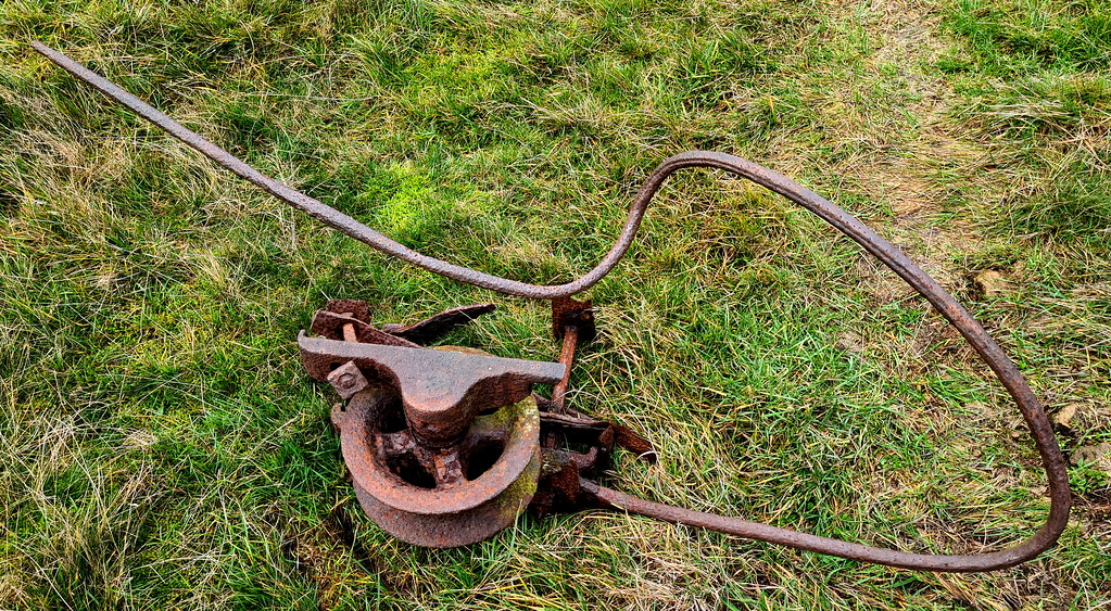
Interesting bit of iron machinery:
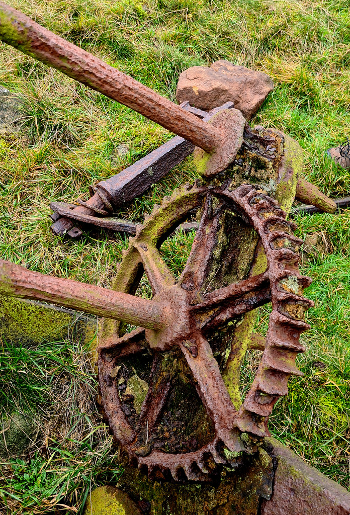
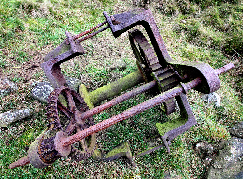
This looks like some sort of pully system:
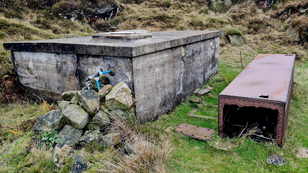
And finally, nearby, some sort of water tank system:
THAT'S ALL FOLKS!!!
Map:
A: Boot’s Folly
B: Doric Columns
C: Sugworth Delph Quarry
1. Boot’s Folly:
High on the south bank of the Strines reservoir, at a height of 315 metres, stands Boot's Folly. Also known as Strines Tower or Sugworth Tower, the folly’s official name came from its constructer, Charles Boot, who built the folly in 1927, who resided in the nearby Sugworth Hall. His father was the founder of the local construction company, Henry Boot plc. The 45-foot-high square tower with castellated top and flagpole was built from leftover stone from nearby Bent’s House. In turn the stone for Bents House had come from the disused Bents Farm, Pears House Farm and Nether Holes Farm which had been demolished because they were suspected of polluting the waters in the dale. Boot's Folly was most likely constructed to provide work for Sugworth Hall’s workmen during The Depression. There is also a theory that Charles Boot built the tower so he could see High Bradfield churchyard where his wife who had died the year before in 1926, aged 56, was buried.
The interior is now bare. It originally had wood panelling and a large furnished room at the top where the Boot family could enjoy panoramic views across the moors. There was a spiral staircase to the top. This was removed, however, some years ago after a cow climbed the stairs and became stuck. The Folly gives fine views of the reservoir and Bradfield Dale.
The folly can be seen from miles around:
The folly is pretty sturdy:
Can’t make out what the door lintel stone says on it:
Inside, sadly, no way up:
The remnants of the former staircase:
2. Doric columns
Nearby, laid out on the grass, are as set of beautifully carved columns and capitals. The stones were originally part of Brunswick Chapel which was at the bottom of Sheffield Moor and designed by architect John Grey Weightman. Constructed in 1833, the chapel was bombed during the Second World War. After the war, Mr Boot was charged with demolishing the chapel safe, so too the opportunity to salvage the masonry, bringing it up to his house on the moors for safe keeping. He may have even planned to build a smaller folly using the stones.
The columns with the folly in the background:
Some cracking Corinthian capitals:
Just sat there, doing nothing:
A square base here:
Strines reservoir in the background:
3. Sugworth Delph Quarry
A small stone quarry, due east of the stones. No information on this place whatsoever, so hard to cast any light on what was quarried and when the quarry was active. Interesting to see some on the machinery used in the quarry still in situ.
The quarry is small but quite photogenic:
Tower of stone:
Interesting bit of iron machinery:
This looks like some sort of pully system:
And finally, nearby, some sort of water tank system:
THAT'S ALL FOLKS!!!