- Joined
- Jan 6, 2013
- Messages
- 5,606
- Reaction score
- 11,273
(1) The History
Located just under a mile south of the Derbyshire village of Calver, not an enormous amount of history is available on this small lead mine. It was first worked in the 19th Century and is associated with two periods of intense mining activity: namely the early 1850s and the first two decades of the twentieth century. It is shown as ‘disused’ by according to an 1879 Ordnance Survey (OS) map which indicates a relatively small site consisting of a shaft and an adit portal to the east. A straight track ran east from the portal, terminating in a circular feature which has been interpreted as possibly a pond, rather than a dressing circle. To the north were two buildings and another circular feature.
The first written reference to Red Rake is an agreement from 24th December 1803 that identifies a George Graham as the proprietor of Red Rake. A latter document states that Cornish mining engineer, John Taylor, to be the owner between 1839 and 1851. In 1851, the Newburgh adit was constructed by the North Derbyshire United Mining Company as a haulage level (and not a drainage sough as it was frequently taken to be) for Red Rake, Cat (or Catsal) Rake, Dog Rake, and other smaller veins in Northcliffe Wood. The name Newburgh is derived from the ‘Earl of Newburgh’, who was the associated landowner and ‘lord’ of the Liberty of Calver.
An old mineral book identified the mine as producing lead up to and throughout the 1870s, but with output decreasing. By 1880, stone and gravel are recorded as being extracted from the mine in “significant amounts” after lead production ceased circa 1883. A barmaster’s declaration, a year later in December 1884 states Red Rake Mine was closed due to “lack of work”. Latterly, G. G. Blackwell and Sons reopened Red Rake in the first decade of the 20th century, most likely around 1907, to support the expansion of fluorspar production due to its use as a flux in the expanding steel-making industry. It was also reworked for lead and barites. This phase lasted until around July 1919, based on the final wage references for Red Rake.
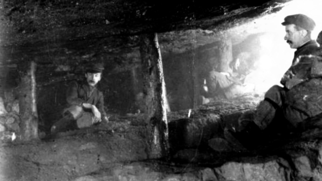
Three miners inside Red Rake, 1910:
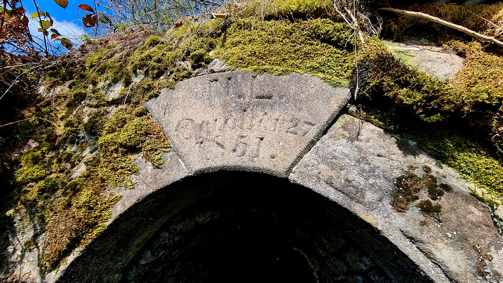
Red Rake was intermittently worked by the Bleaklow Mining Co Ltd up until the late 1980s. By the 1990s, ownership had transferred to Laportes Ltd who cleared and tidied the site up, including the capping of two shafts adjacent to the Newburgh level, and the levelling and landscaping of mining hillocks and spoil heaps. In 1999, Red Rake was sold on by Laportes to Glebe Mines. The portal was previously preserved by the Peak District Mines Historical Society (PDMHS) and was officially listed in April 1982 as a rare example of a dated adit portal. Built of gritstone, the edge-shaped keystone is clearly inscribed with the initials ‘N.L’ (standing for Newburgh Level) and the date October 27 1851. Aside from the adit, other surface buildings survive, including a 20th century ‘incline’ or ore chute and its walled loading bay at the roadside, the remains of a small 20th century spar plant (including concrete platforms, a small machinery bed, yards and buildings) and, to the south-east, a 20th century powder house with partially collapsed vaulted brick roof.
2. The Explore
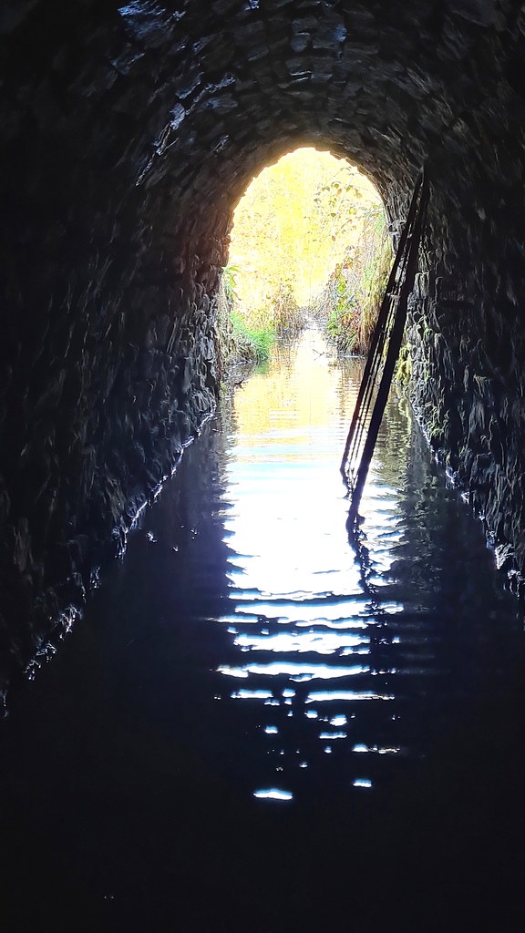
First time for this place being reported, properly, on here. Came across this place back in March 2021, however didn’t have any waders so it was a no go. Taken me just over a year but I finally got round to going back, this time equipped with said waders. First time was solo so didn’t venture too far in. A few days later, came back with my regular, non-forum mine-exploring buddy J. And what a gem of a place this is. The lovely drystone arched adit entrance with date stone is just the start.
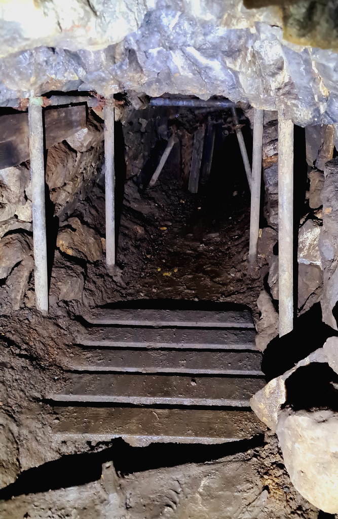
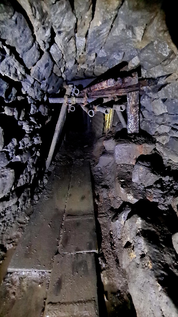
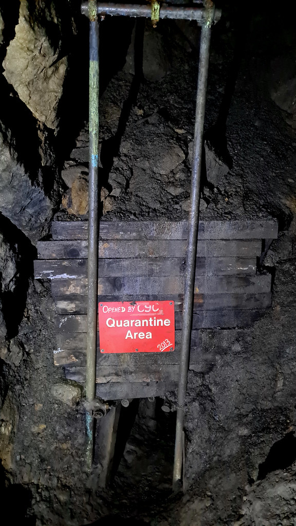
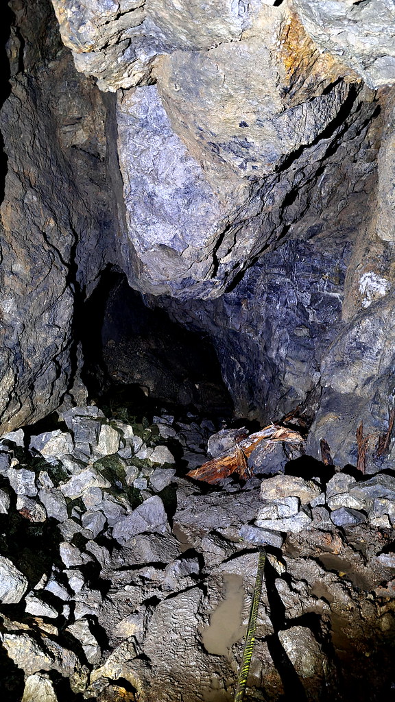
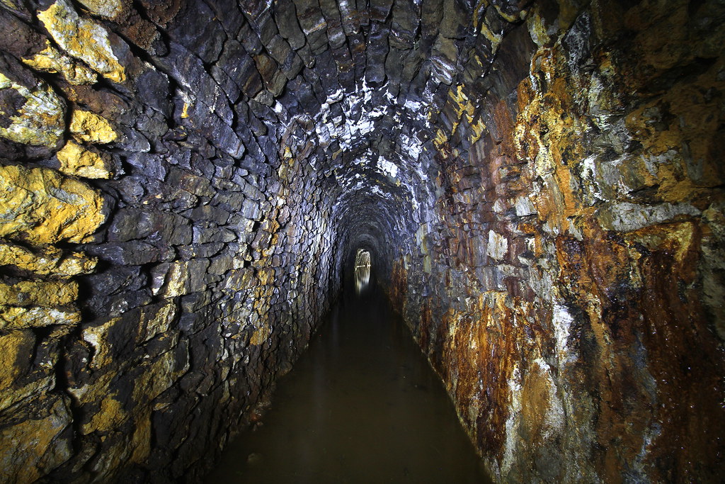
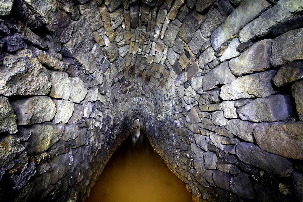
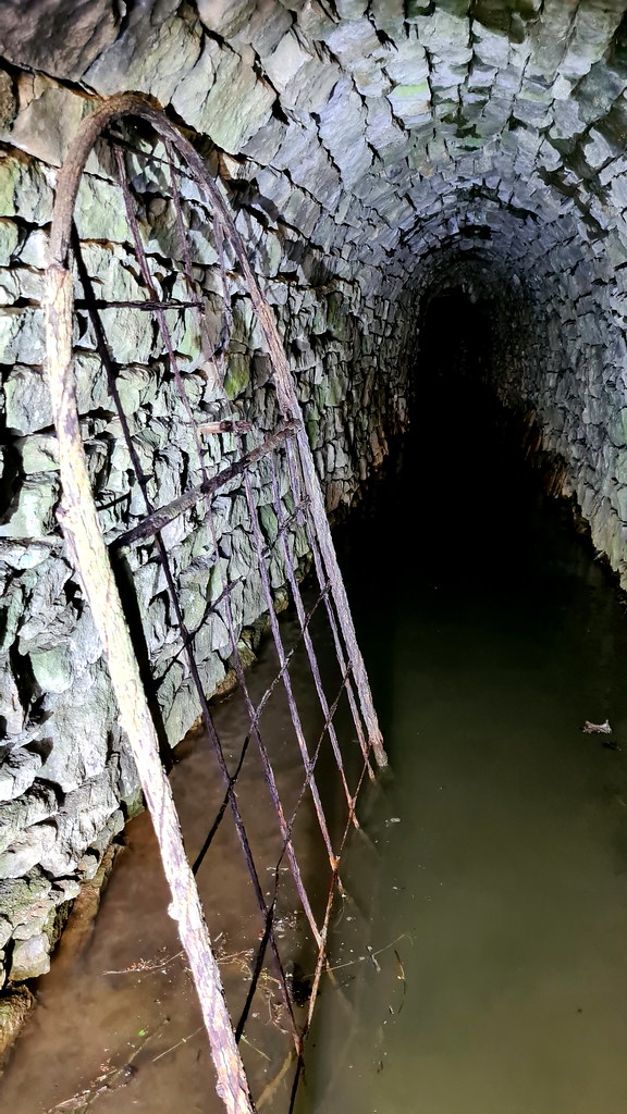
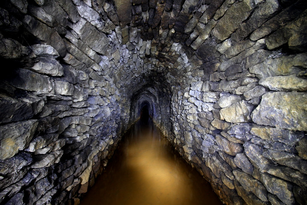
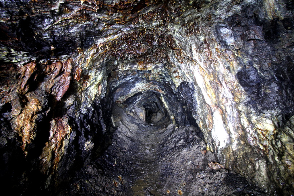
The lead mine can be split into four sections. The first section is the stone lined adit from 1851. This runs for approximately 40m and is just below wader level in water. Apart from the lovely stonework there not too much to see, aside from the propped up former metal gate, the proverbial rusty hook in the wall and a minor ceiling collapse. Next you arrive at a rough rock cut section with remnants of more recent activity that goes on for 15 or so metres. There’s some lovely mineralisation, some old kitchen sinks and some metal and plastic mining detritus. Mid-way along an inclined passage rises up to the right-hand side but soon ends in a dead-end. Next up is a stone-lined arch section that has been lined with scaffold, most likely due to potential collapses which means for 10m you are reduced to a hands and knees crawl. You then pop out of a narrow wooden aperture, and you are into the main stope-based working this rise up for a number of metres. Here I went on for another 50m until I reached a point where a rope climb was required and as at this point, I was solo, decided to double back. Clearly the mine continues way beyond this point, so this is one for a future revisit.
3. The Pictures
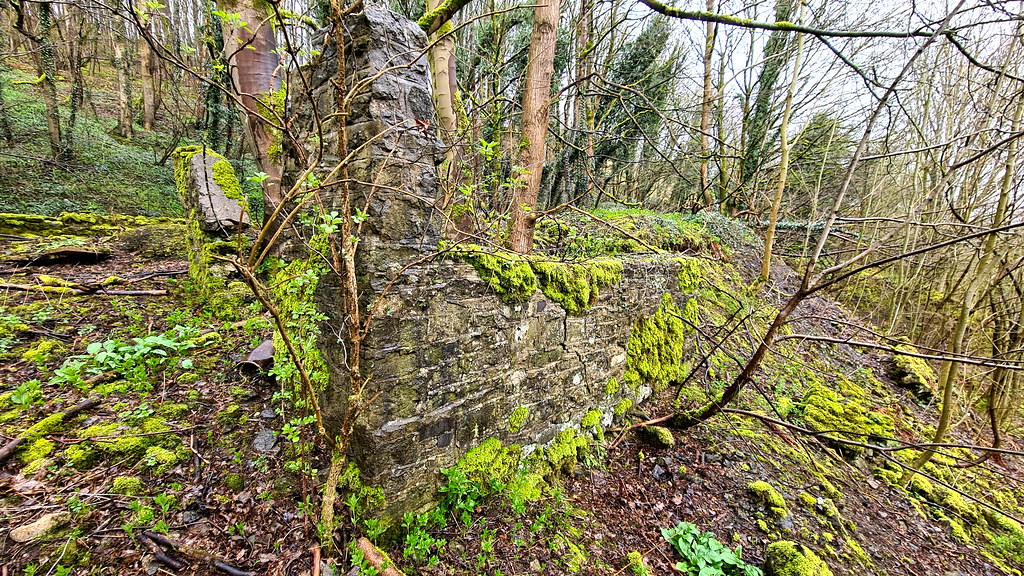
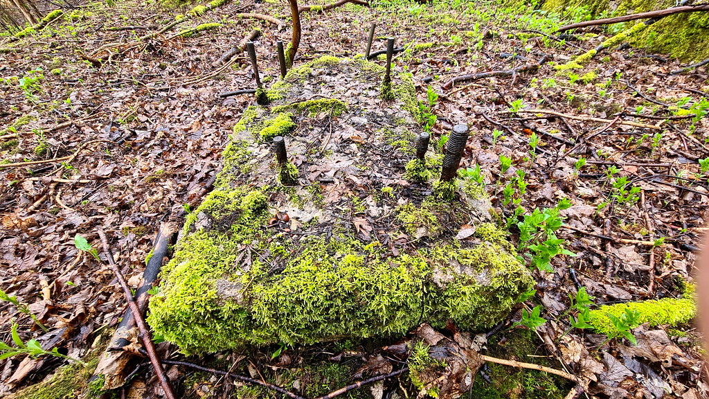
At the top of the road there are the remains of a small 20th century spar plant:
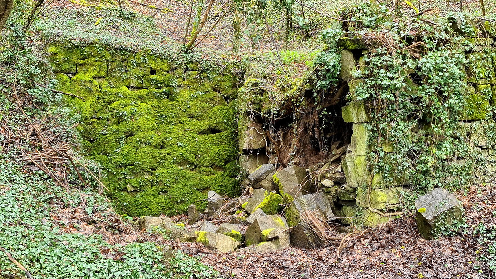
Nearby are the remnants of the 20th century powder house :
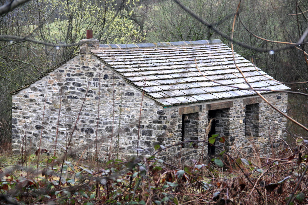
Then, down the hill on to the mine entrance there is this recently restored mining building. Its purpose is unknown, but due to its close location to the mine entrance, it may have been a smithy or welfare facility:
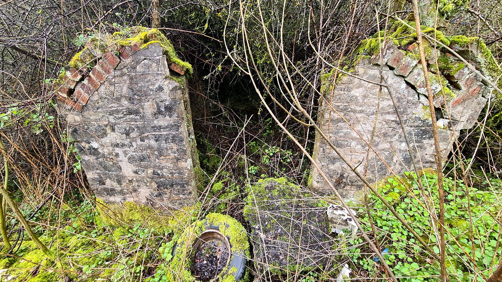
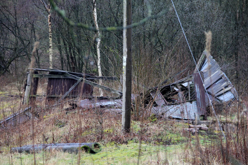
And this collapsed building:
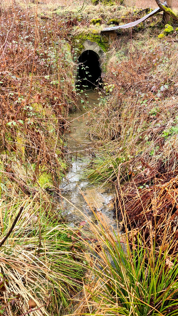
On to the Newburgh Level adit entrance itself:
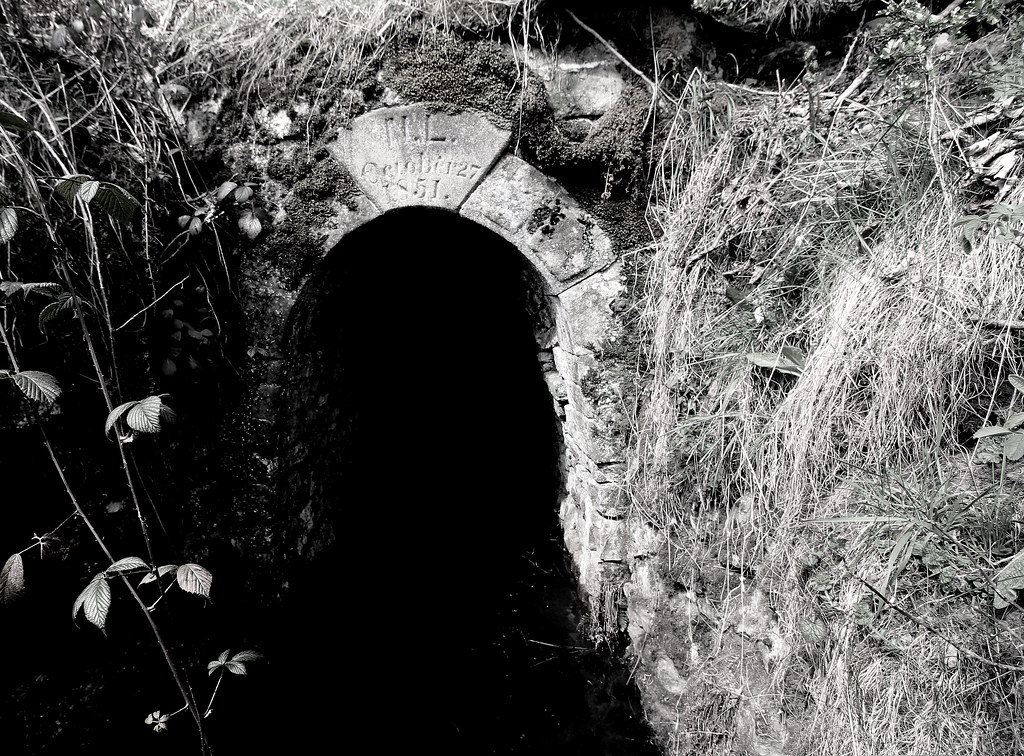
You can just about make out the lettering/numbers:
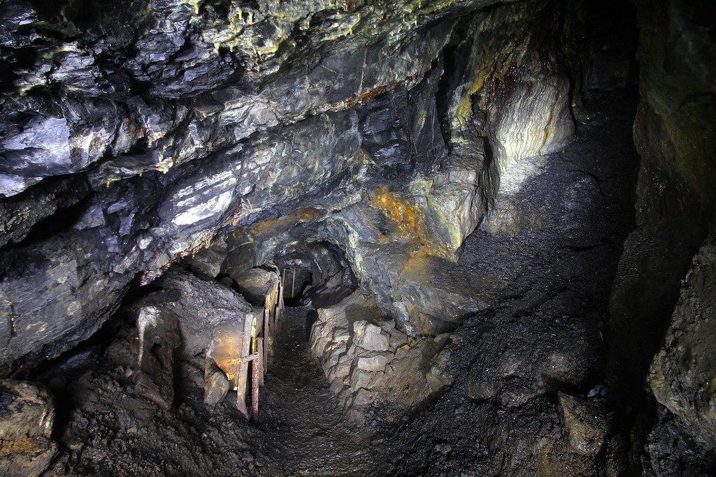
In we go:
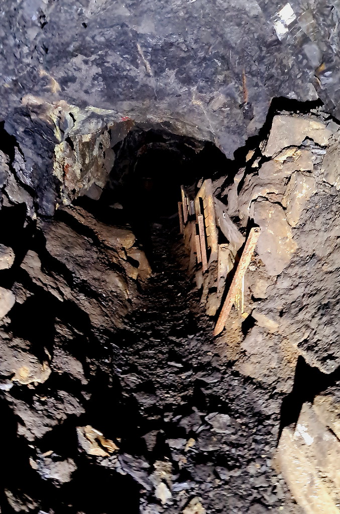
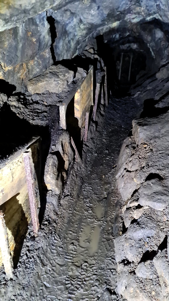
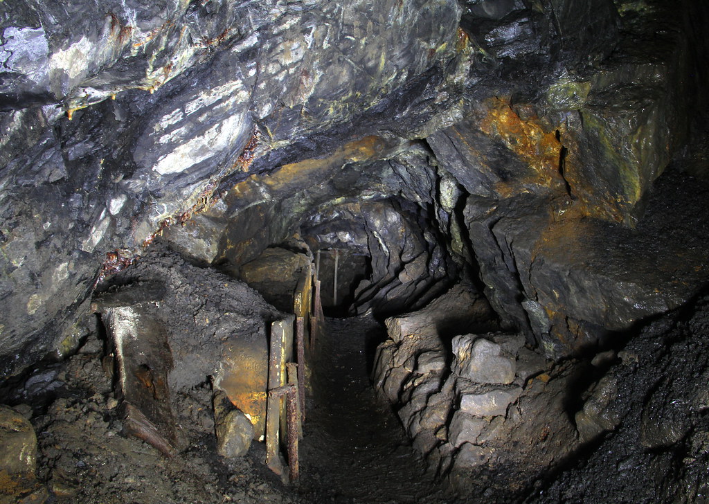
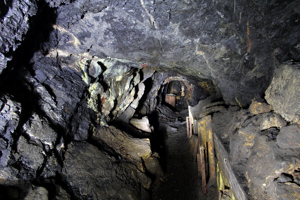
At the end of the stone lined adit, the rock cut section starts:
Stacked deads at the side:
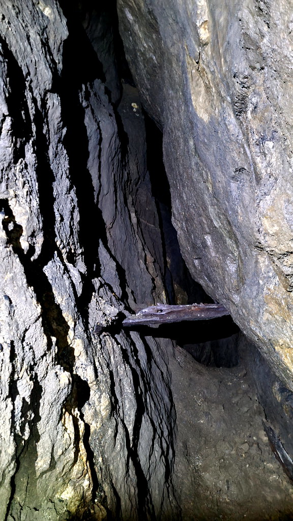
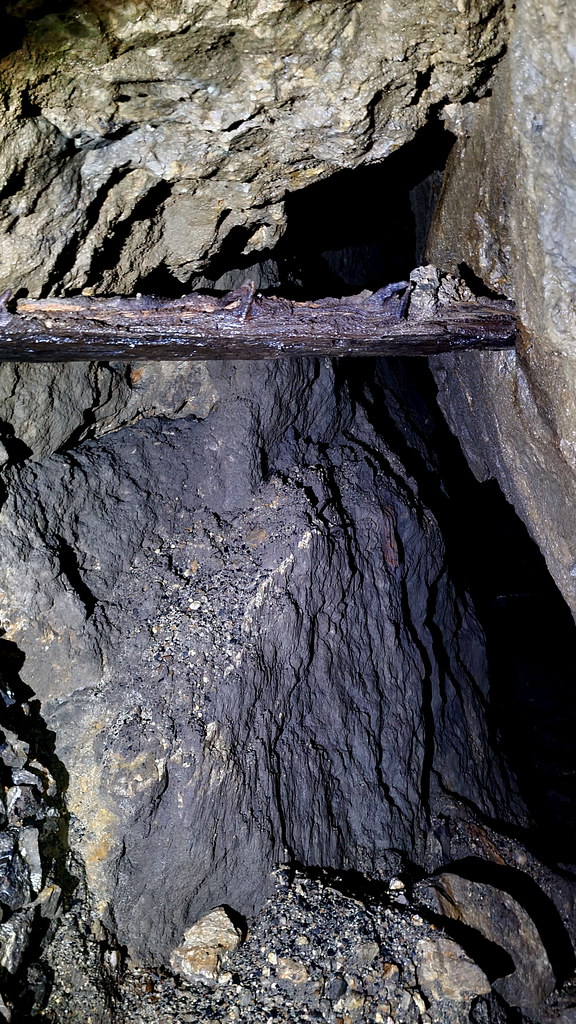
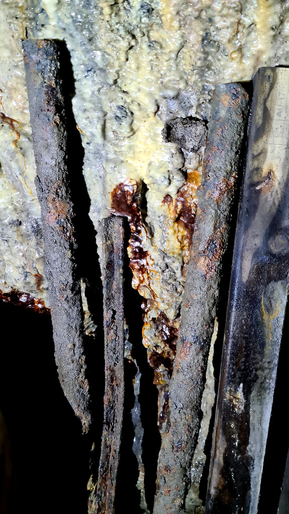
Assorted iron rods:
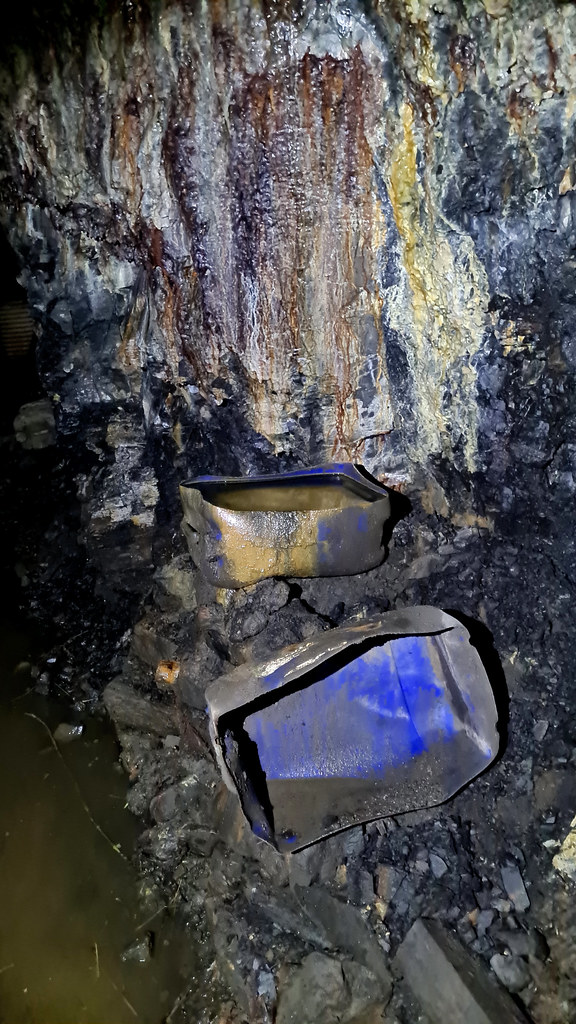
We’ve even got the kitchen sink!
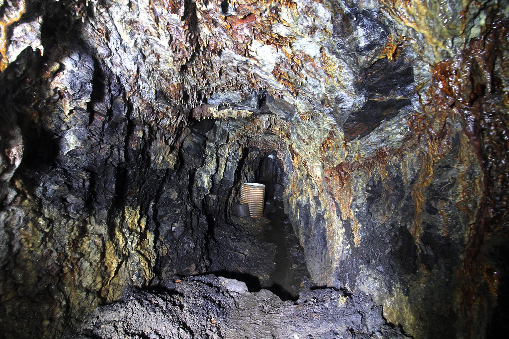
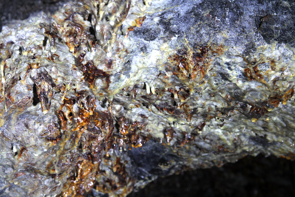
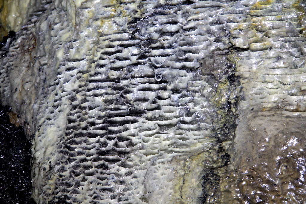
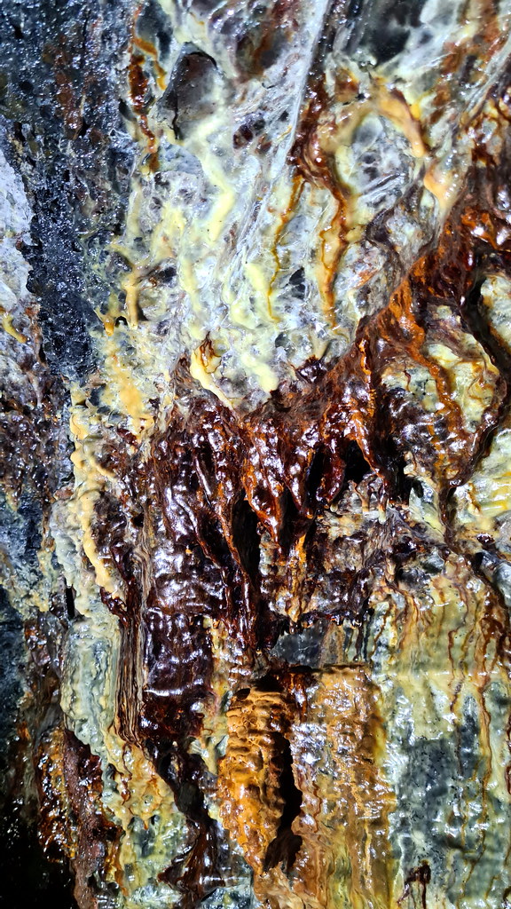
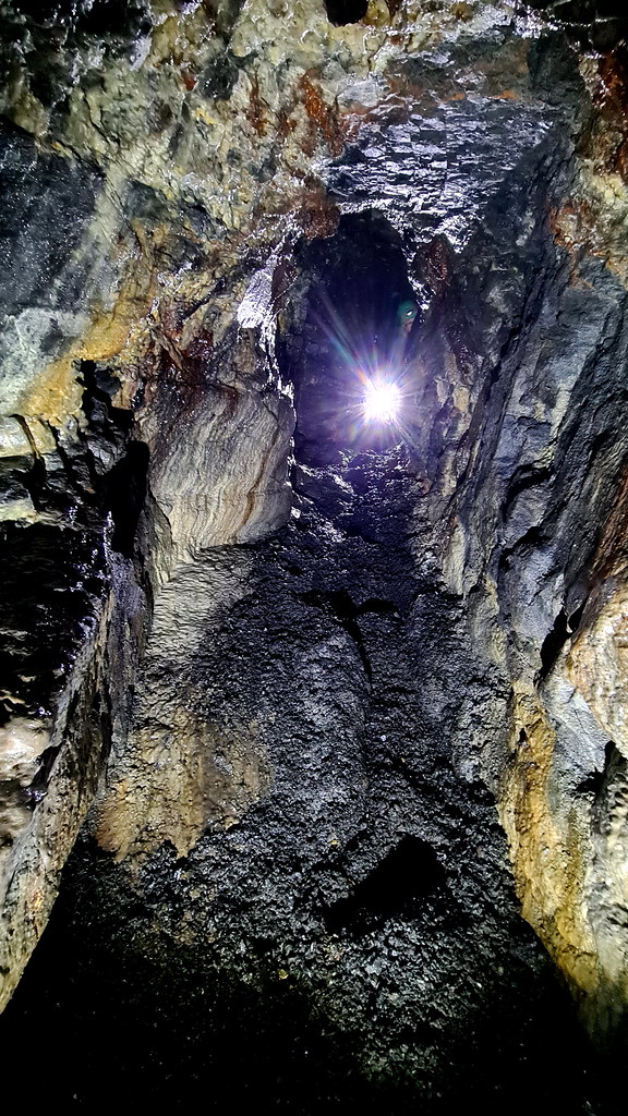
The mineralisation is stunning:
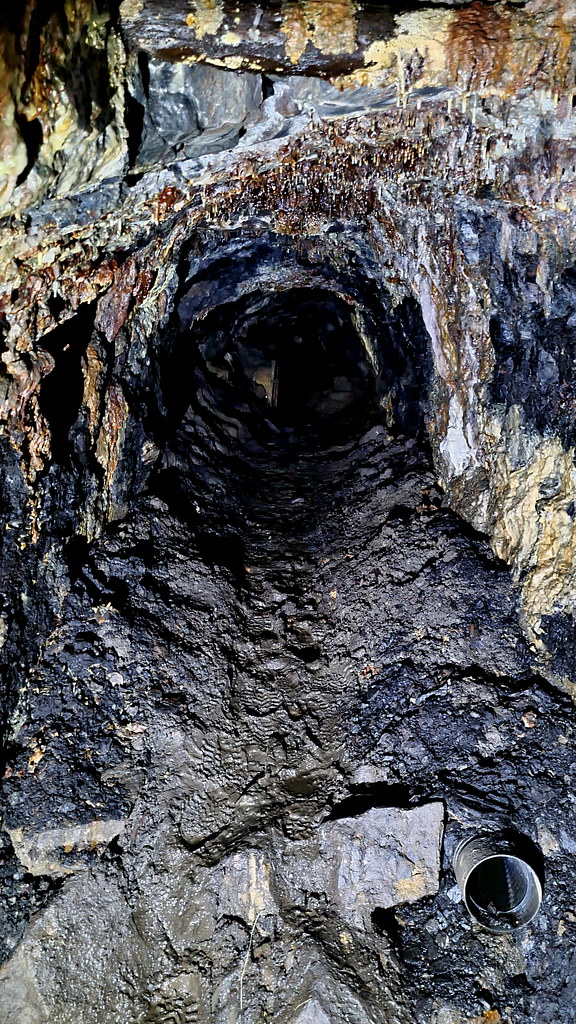
The incline up to the right soon ends in a dead end:
Located just under a mile south of the Derbyshire village of Calver, not an enormous amount of history is available on this small lead mine. It was first worked in the 19th Century and is associated with two periods of intense mining activity: namely the early 1850s and the first two decades of the twentieth century. It is shown as ‘disused’ by according to an 1879 Ordnance Survey (OS) map which indicates a relatively small site consisting of a shaft and an adit portal to the east. A straight track ran east from the portal, terminating in a circular feature which has been interpreted as possibly a pond, rather than a dressing circle. To the north were two buildings and another circular feature.
The first written reference to Red Rake is an agreement from 24th December 1803 that identifies a George Graham as the proprietor of Red Rake. A latter document states that Cornish mining engineer, John Taylor, to be the owner between 1839 and 1851. In 1851, the Newburgh adit was constructed by the North Derbyshire United Mining Company as a haulage level (and not a drainage sough as it was frequently taken to be) for Red Rake, Cat (or Catsal) Rake, Dog Rake, and other smaller veins in Northcliffe Wood. The name Newburgh is derived from the ‘Earl of Newburgh’, who was the associated landowner and ‘lord’ of the Liberty of Calver.
An old mineral book identified the mine as producing lead up to and throughout the 1870s, but with output decreasing. By 1880, stone and gravel are recorded as being extracted from the mine in “significant amounts” after lead production ceased circa 1883. A barmaster’s declaration, a year later in December 1884 states Red Rake Mine was closed due to “lack of work”. Latterly, G. G. Blackwell and Sons reopened Red Rake in the first decade of the 20th century, most likely around 1907, to support the expansion of fluorspar production due to its use as a flux in the expanding steel-making industry. It was also reworked for lead and barites. This phase lasted until around July 1919, based on the final wage references for Red Rake.
Three miners inside Red Rake, 1910:
Red Rake was intermittently worked by the Bleaklow Mining Co Ltd up until the late 1980s. By the 1990s, ownership had transferred to Laportes Ltd who cleared and tidied the site up, including the capping of two shafts adjacent to the Newburgh level, and the levelling and landscaping of mining hillocks and spoil heaps. In 1999, Red Rake was sold on by Laportes to Glebe Mines. The portal was previously preserved by the Peak District Mines Historical Society (PDMHS) and was officially listed in April 1982 as a rare example of a dated adit portal. Built of gritstone, the edge-shaped keystone is clearly inscribed with the initials ‘N.L’ (standing for Newburgh Level) and the date October 27 1851. Aside from the adit, other surface buildings survive, including a 20th century ‘incline’ or ore chute and its walled loading bay at the roadside, the remains of a small 20th century spar plant (including concrete platforms, a small machinery bed, yards and buildings) and, to the south-east, a 20th century powder house with partially collapsed vaulted brick roof.
2. The Explore
First time for this place being reported, properly, on here. Came across this place back in March 2021, however didn’t have any waders so it was a no go. Taken me just over a year but I finally got round to going back, this time equipped with said waders. First time was solo so didn’t venture too far in. A few days later, came back with my regular, non-forum mine-exploring buddy J. And what a gem of a place this is. The lovely drystone arched adit entrance with date stone is just the start.
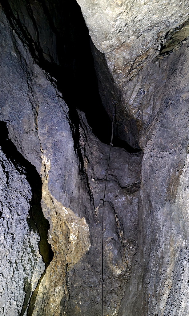
The lead mine can be split into four sections. The first section is the stone lined adit from 1851. This runs for approximately 40m and is just below wader level in water. Apart from the lovely stonework there not too much to see, aside from the propped up former metal gate, the proverbial rusty hook in the wall and a minor ceiling collapse. Next you arrive at a rough rock cut section with remnants of more recent activity that goes on for 15 or so metres. There’s some lovely mineralisation, some old kitchen sinks and some metal and plastic mining detritus. Mid-way along an inclined passage rises up to the right-hand side but soon ends in a dead-end. Next up is a stone-lined arch section that has been lined with scaffold, most likely due to potential collapses which means for 10m you are reduced to a hands and knees crawl. You then pop out of a narrow wooden aperture, and you are into the main stope-based working this rise up for a number of metres. Here I went on for another 50m until I reached a point where a rope climb was required and as at this point, I was solo, decided to double back. Clearly the mine continues way beyond this point, so this is one for a future revisit.
3. The Pictures
At the top of the road there are the remains of a small 20th century spar plant:
Nearby are the remnants of the 20th century powder house :
Then, down the hill on to the mine entrance there is this recently restored mining building. Its purpose is unknown, but due to its close location to the mine entrance, it may have been a smithy or welfare facility:
And this collapsed building:
On to the Newburgh Level adit entrance itself:
You can just about make out the lettering/numbers:
In we go:
At the end of the stone lined adit, the rock cut section starts:
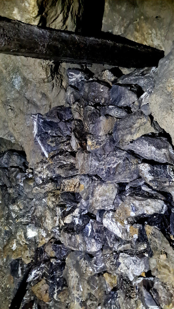
Stacked deads at the side:
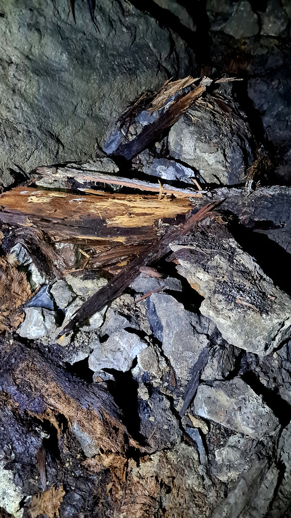
Assorted iron rods:
We’ve even got the kitchen sink!
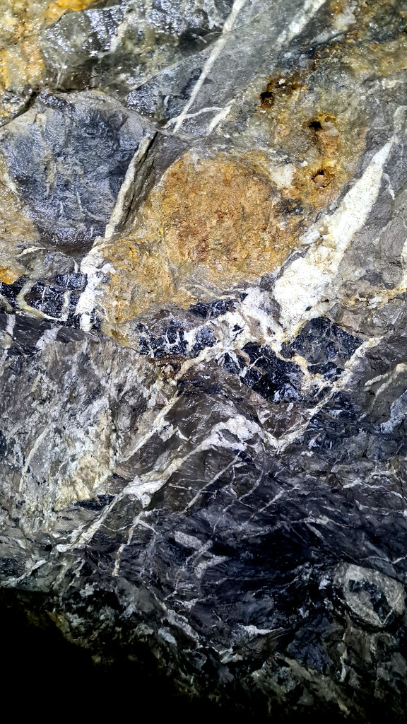
The mineralisation is stunning:
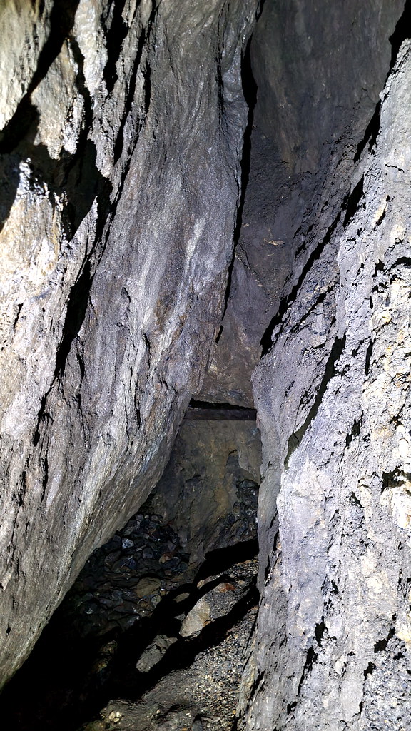
The incline up to the right soon ends in a dead end: