


Seahorse
Grumpy auld mod.
Absolutely gorgeous weather this morning. So despite a toe with lumps of bone chipped off of it, I decided it was time to go gather some more pillbox data from the Rattray Stop Line.
First stop... the car park near St. Fergus. Whilst this pillbox isn't strictly part of the Rattray defences, I thought it best to get it logged anyhow. Coords are: 57°33'36.74"N, 001°48'45.45"W (Roughly, give or take a few meters.)
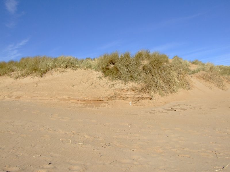
Whadeyemean, you can't see a pillbox??? Trust me, it's under there right enough. Although I haven't seen it in about 17 years, I must admit.
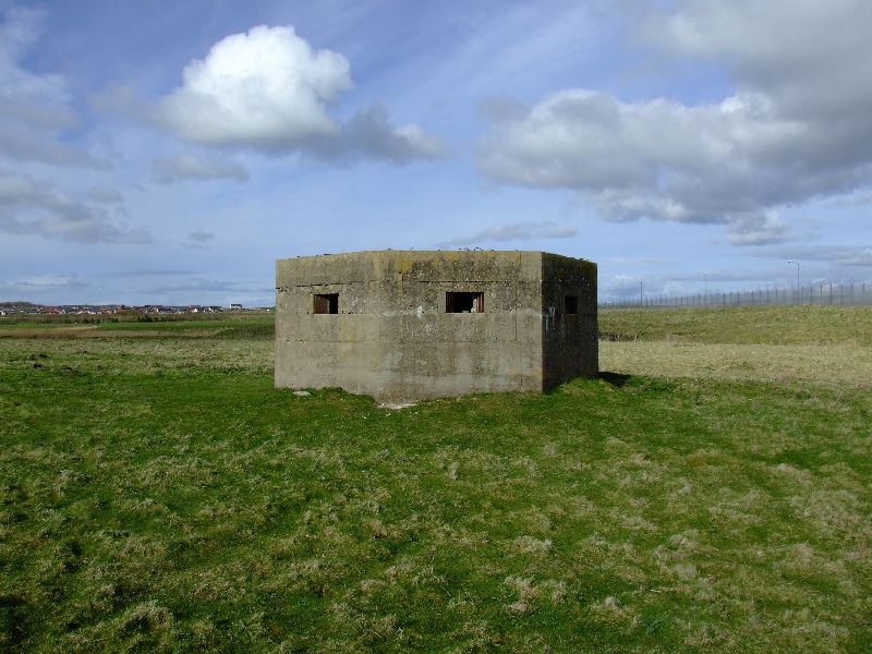
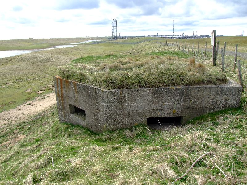
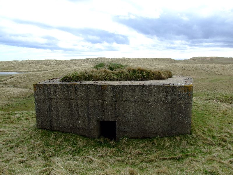
OK,heading north on to the next one. This is the southernmost pillbox, located close to Annachie Bridge
Coords: 57°34'3.88"N, 001°49'30.03"W
Initials incscribed into the MG table when the concrete was wet? Or a bored Home Guard bod?
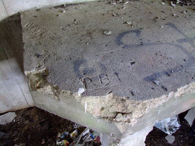
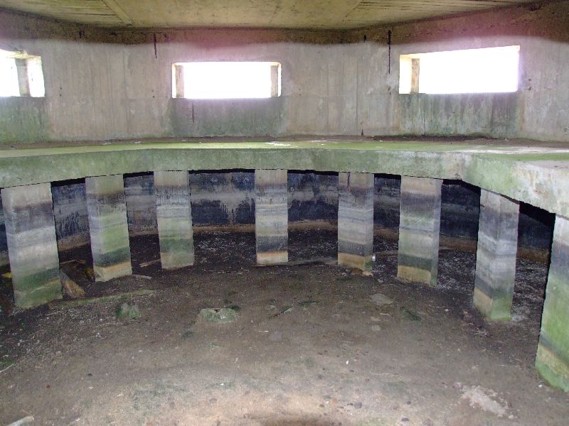
MG table
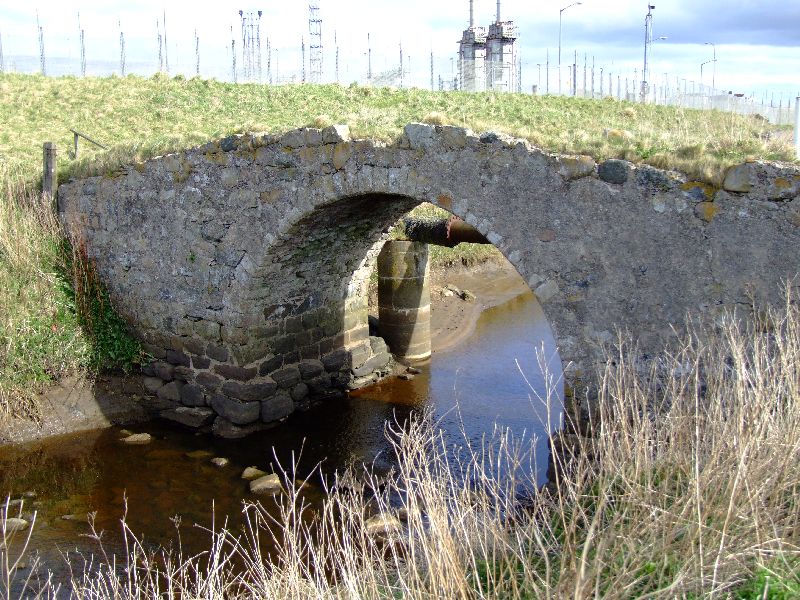
The aforementioned Annachie Bridge. With St. Fergus gas terminal in the background. Beware of armed chappies in black, driving 4x4's.
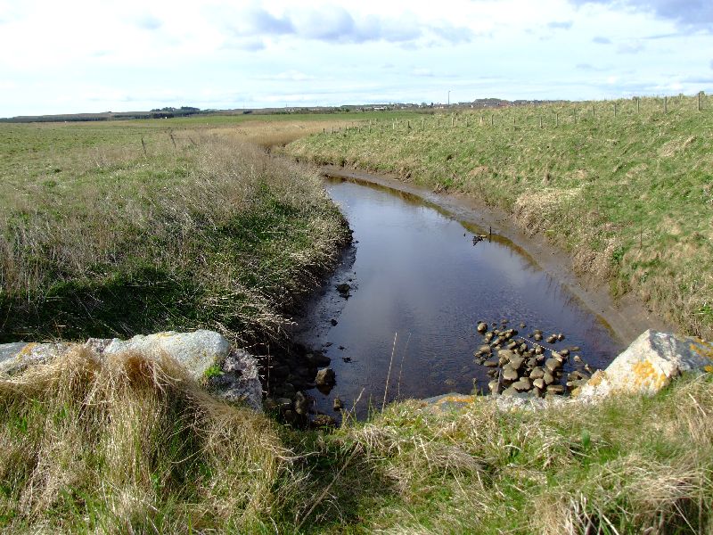
Annachie Burn. Natural defence supplementing an extensive array of anti tank ditches in the locale.
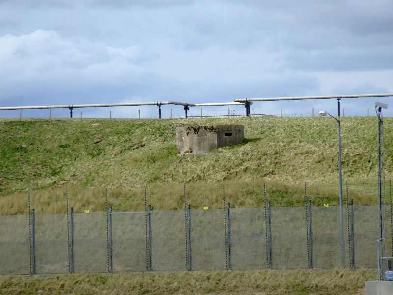
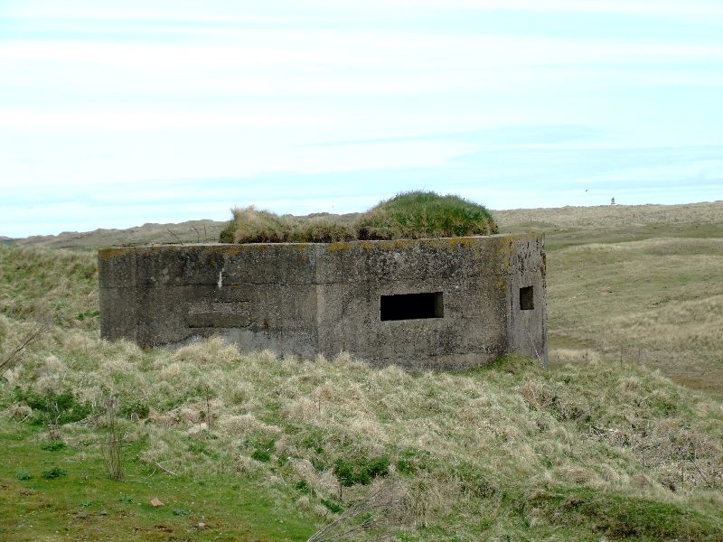
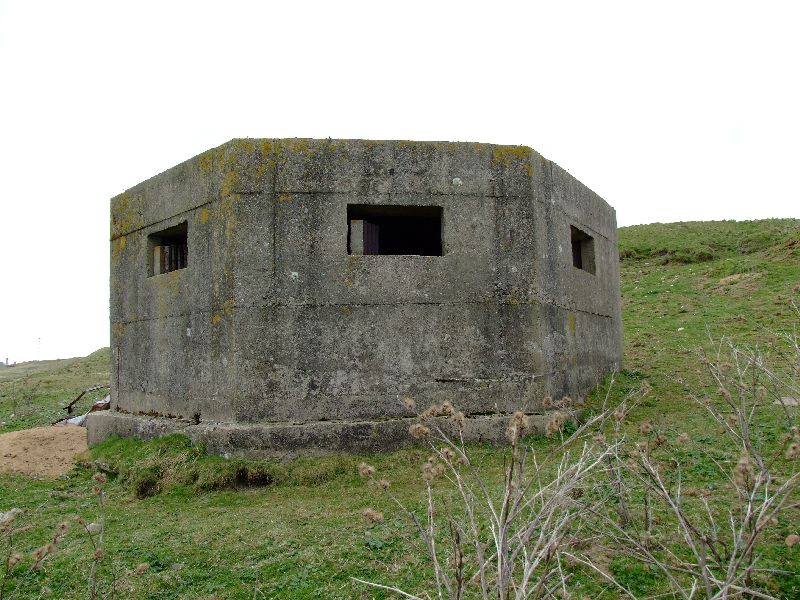
Next up is this one, situated inside the perimeter fence. Impossible to get closer without risking several thousand volts up yer jacksey. But you can see that 2 embrasures have been filled, whether recently or not, I have no idea.
Coords: 57°34'33.28"N, 001°49'52.59"W
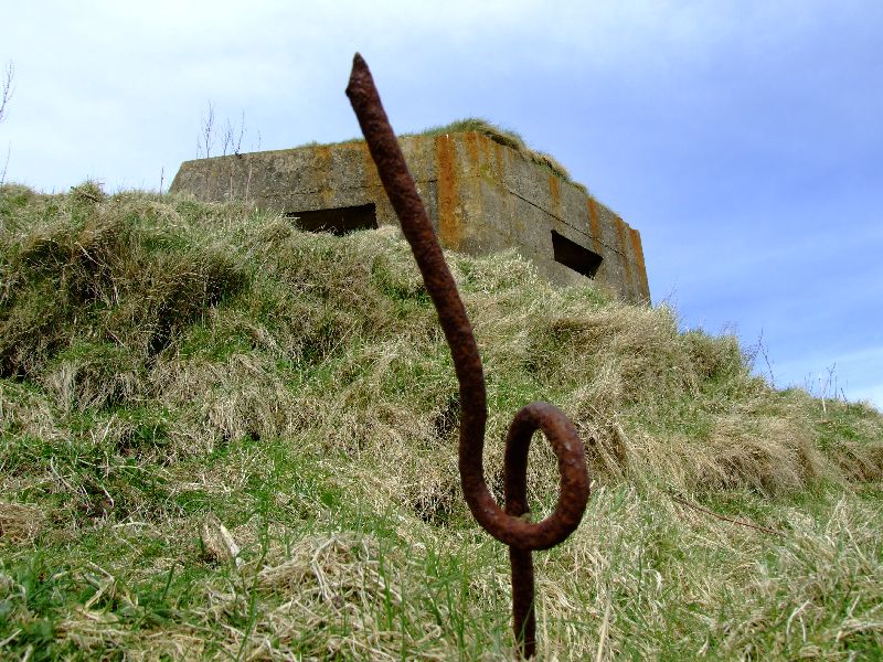
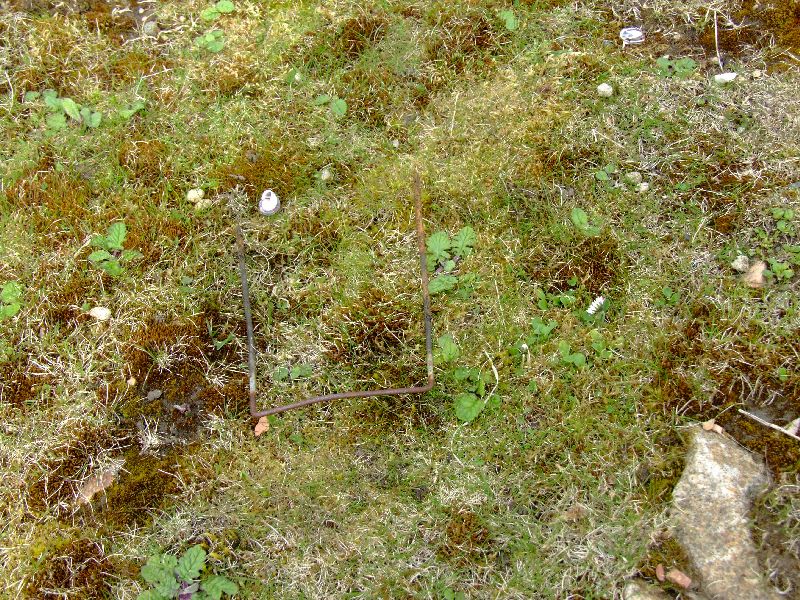
Onwards and upwards. I rather like the first shot. The object in front is a picket for supporting the barbed wire which filled much of the surrounding area.
Coords: 57°34'52.75"N, 001°50'1.62"W
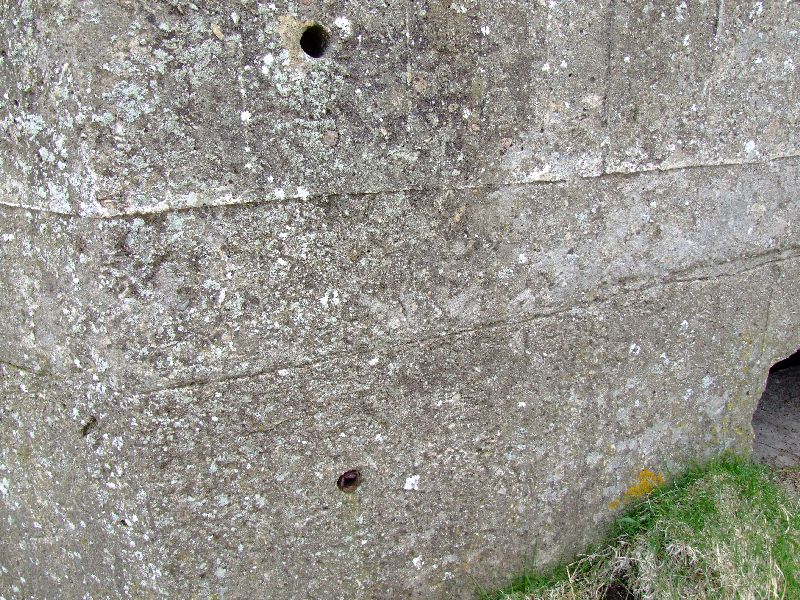
Rawlbolt type holes, suggesting an erection (ooer, missus!!!) of some kind was bolted to the exterior.
MG tables seem to have been the Must Have fashion accessory for pillboxes in this part of the country.
And on we go again. I did wonder about the infilled embrasures on this one. But a closer examination of the ground in the immediate area suggests one answer: to the left and right, i.e. in direct line of fire were the embrasures NOT blocked, are what appear to be trenches. Could it be that that the Home Guard were not to be trusted not to engage in "friendly fire"?
Coords: 57°35'24.27"N, 001°50'7.41"W
In the ground at the bottom left of the above photo, there are still some of these little beauties; galvanised steel staples, for pinning the bottom of cam net/hessian to the ground. Yes, I DID pull this out for the photo, but yes I DID put it back again.
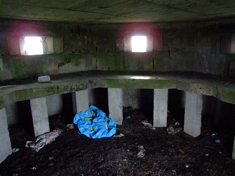
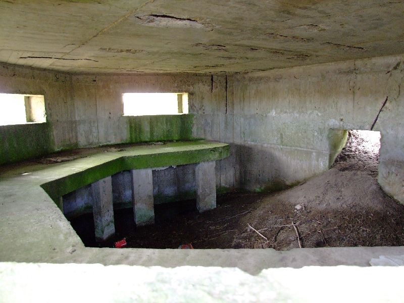
No loopholes in the back of this one for some reason. Another thing I discovered was, the doorways are REALLY low. I had thought looking at other pillboxes that were infilled with sand, that the height was low because of the build up of sand. Wrong. Either guys were very short in those days, or any enemy trying to get in would have had to stoop, leaving himself vulnerable as he did so.
ANOTHER MG table. I wonder if they had enough guns to actually equip each pillbox??? Note the concrete floor is visible, confirming the low head height of the doorway.
And the last one of the day. Time beat me unfortunately. Plus the park was full of coos, that were getting inquisitive. Maybe they were Mod Plods in disguise?
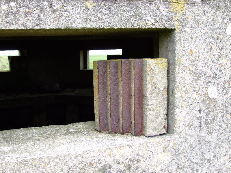
Note the unusual arrangement in the embrasures? What's that all about?
Coords: 57°35'29.54"N, 001°50'16.05"W
I'm beginning to think they ate their dinner off these things.
And so to bed. Or summat.
First stop... the car park near St. Fergus. Whilst this pillbox isn't strictly part of the Rattray defences, I thought it best to get it logged anyhow. Coords are: 57°33'36.74"N, 001°48'45.45"W (Roughly, give or take a few meters.)
Whadeyemean, you can't see a pillbox??? Trust me, it's under there right enough. Although I haven't seen it in about 17 years, I must admit.
OK,heading north on to the next one. This is the southernmost pillbox, located close to Annachie Bridge
Coords: 57°34'3.88"N, 001°49'30.03"W
Initials incscribed into the MG table when the concrete was wet? Or a bored Home Guard bod?
MG table
The aforementioned Annachie Bridge. With St. Fergus gas terminal in the background. Beware of armed chappies in black, driving 4x4's.
Annachie Burn. Natural defence supplementing an extensive array of anti tank ditches in the locale.
Next up is this one, situated inside the perimeter fence. Impossible to get closer without risking several thousand volts up yer jacksey. But you can see that 2 embrasures have been filled, whether recently or not, I have no idea.
Coords: 57°34'33.28"N, 001°49'52.59"W
Onwards and upwards. I rather like the first shot. The object in front is a picket for supporting the barbed wire which filled much of the surrounding area.
Coords: 57°34'52.75"N, 001°50'1.62"W
Rawlbolt type holes, suggesting an erection (ooer, missus!!!) of some kind was bolted to the exterior.
MG tables seem to have been the Must Have fashion accessory for pillboxes in this part of the country.
And on we go again. I did wonder about the infilled embrasures on this one. But a closer examination of the ground in the immediate area suggests one answer: to the left and right, i.e. in direct line of fire were the embrasures NOT blocked, are what appear to be trenches. Could it be that that the Home Guard were not to be trusted not to engage in "friendly fire"?
Coords: 57°35'24.27"N, 001°50'7.41"W
In the ground at the bottom left of the above photo, there are still some of these little beauties; galvanised steel staples, for pinning the bottom of cam net/hessian to the ground. Yes, I DID pull this out for the photo, but yes I DID put it back again.
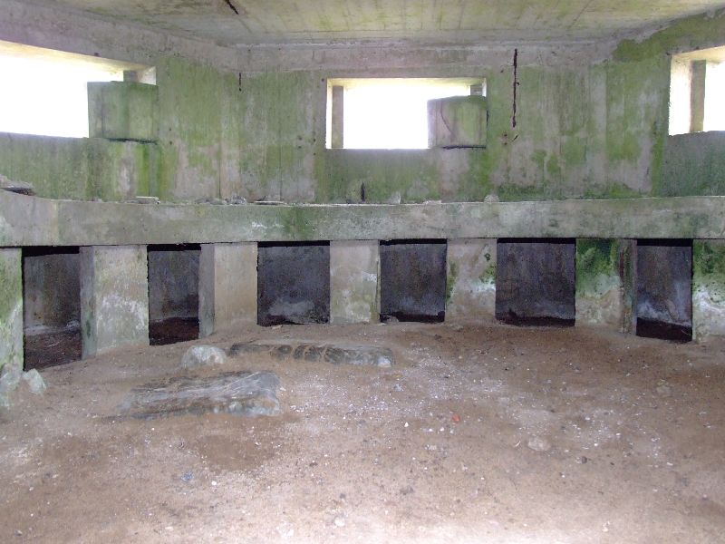
No loopholes in the back of this one for some reason. Another thing I discovered was, the doorways are REALLY low. I had thought looking at other pillboxes that were infilled with sand, that the height was low because of the build up of sand. Wrong. Either guys were very short in those days, or any enemy trying to get in would have had to stoop, leaving himself vulnerable as he did so.
ANOTHER MG table. I wonder if they had enough guns to actually equip each pillbox??? Note the concrete floor is visible, confirming the low head height of the doorway.
And the last one of the day. Time beat me unfortunately. Plus the park was full of coos, that were getting inquisitive. Maybe they were Mod Plods in disguise?
Note the unusual arrangement in the embrasures? What's that all about?
Coords: 57°35'29.54"N, 001°50'16.05"W
I'm beginning to think they ate their dinner off these things.
And so to bed. Or summat.
